Rosières-en-Santerre
Jump to navigation
Jump to search
Rosières-en-Santerre | |
|---|---|
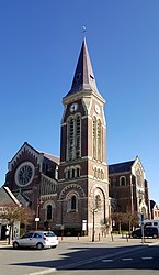
 The church in Rosières-en-Santerre | |
| Coordinates: 49°48′54″N 2°42′11″E / 49.815°N 2.7031°ECoordinates: 49°48′54″N 2°42′11″E / 49.815°N 2.7031°E | |
| Country | France |
| Region | Hauts-de-France |
| Department | Somme |
| Arrondissement | Péronne |
| Canton | Moreuil |
| Intercommunality | CC Terre de Picardie |
| Government | |
| • Mayor (2020–2026) | Françoise Maille-Barbare |
| Area 1 | 12.98 km2 (5.01 sq mi) |
| Time zone | UTC+01:00 (CET) |
| • Summer (DST) | UTC+02:00 (CEST) |
| INSEE/Postal code | 80680 /80170 |
| Elevation | 70–106 m (230–348 ft) (avg. 91 m or 299 ft) |
| 1 French Land Register data, which excludes lakes, ponds, glaciers > 1 km2 (0.386 sq mi or 247 acres) and river estuaries. | |
Rosières-en-Santerre (French pronunciation: [ʁozjɛʁ ɑ̃ sɑ̃tɛʁ], literally Rosières in Santerre) is a commune in the Somme department in Hauts-de-France in northern France.
Geography
The commune is situated some 20 kilometres (12 mi) southeast of Amiens, at the junction of the D28 and D329 roads. Rosières station has rail connections to Amiens and Laon.
Population
| Year | Pop. | ±% p.a. |
|---|---|---|
| 1968 | 2,605 | — |
| 1975 | 2,815 | +1.11% |
| 1982 | 2,985 | +0.84% |
| 1990 | 3,107 | +0.50% |
| 1999 | 2,956 | −0.55% |
| 2007 | 2,877 | −0.34% |
| 2012 | 2,985 | +0.74% |
| 2017 | 3,008 | +0.15% |
| Source: INSEE[1] | ||
Places of interest
- The mairie
- The church
Twin towns
![]() Drochtersen, Germany since 1972
Drochtersen, Germany since 1972
See also
References
External links
Wikimedia Commons has media related to Rosières-en-Santerre.
- Rosières-en-Santerre – Official website (in French)
Categories:
- Articles with short description
- Short description with empty Wikidata description
- Coordinates not on Wikidata
- France articles requiring maintenance
- Commons category link is the pagename
- Articles with French-language sources (fr)
- AC with 0 elements
- Communes of Somme (department)
- All stub articles
- Péronne arrondissement geography stubs


