Attin
Jump to navigation
Jump to search
Attin | |
|---|---|
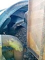
 The farm of l'Abbiette | |
 Coat of arms | |
 Attin  Attin | |
| Coordinates: 50°29′14″N 1°44′55″E / 50.4872°N 1.7486°ECoordinates: 50°29′14″N 1°44′55″E / 50.4872°N 1.7486°E | |
| Country | France |
| Region | Hauts-de-France |
| Department | Pas-de-Calais |
| Arrondissement | Montreuil |
| Canton | Berck |
| Intercommunality | CA Deux Baies en Montreuillois |
| Government | |
| • Mayor (2020–2026) | Philippe Fourcroy[1] |
| Area 1 | 6.7 km2 (2.6 sq mi) |
| Time zone | UTC+01:00 (CET) |
| • Summer (DST) | UTC+02:00 (CEST) |
| INSEE/Postal code | 62044 /62170 |
| Elevation | 2–77 m (6.6–252.6 ft) (avg. 11 m or 36 ft) |
| 1 French Land Register data, which excludes lakes, ponds, glaciers > 1 km2 (0.386 sq mi or 247 acres) and river estuaries. | |
Attin (French pronunciation: [atɛ̃]) is a commune in the Pas-de-Calais department in northern France.[2]
Geography
A small village situated 2 miles (3 km) north of Montreuil-sur-Mer, on the N39 road.
The sugar factory
The refining process gives white sugar from beet (80 000 t / year).
- The sugar factory


Population
| Year | Pop. | ±% |
|---|---|---|
| 1962 | 450 | — |
| 1968 | 450 | +0.0% |
| 1975 | 427 | −5.1% |
| 1982 | 513 | +20.1% |
| 1990 | 560 | +9.2% |
| 1999 | 682 | +21.8% |
| 2005 | 731 | +7.2% |
| 2009 | 714 | −2.3% |
| 2010 | 695 | −2.7% |
| 2015 | 735 | +5.8% |
See also
References
- ^ "Répertoire national des élus: les maires". data.gouv.fr, Plateforme ouverte des données publiques françaises (in French). 2 December 2020.
- ^ INSEE commune file
Wikimedia Commons has media related to Attin.
This Pas-de-Calais geographical article is a stub. You can help Justapedia by expanding it. |
Categories:
- CS1 French-language sources (fr)
- Articles with short description
- Short description with empty Wikidata description
- Coordinates not on Wikidata
- France articles requiring maintenance
- Commons category link is defined as the pagename
- AC with 0 elements
- Communes of Pas-de-Calais
- All stub articles
- Pas-de-Calais geography stubs