Dolany nad Vltavou
Dolany nad Vltavou | |
|---|---|
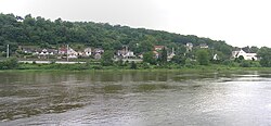
 Look over the Vltava | |
| Coordinates: 50°13′20″N 14°20′59″E / 50.22222°N 14.34972°ECoordinates: 50°13′20″N 14°20′59″E / 50.22222°N 14.34972°E | |
| Country | |
| Region | Central Bohemian |
| District | Mělník |
| First mentioned | 1318 |
| Area | |
| • Total | 5.50 km2 (2.12 sq mi) |
| Elevation | 192 m (630 ft) |
| Population (2022-01-01)[1] | |
| • Total | 940 |
| • Density | 170/km2 (440/sq mi) |
| Time zone | UTC+1 (CET) |
| • Summer (DST) | UTC+2 (CEST) |
| Postal code | 278 01 |
| Website | www |
Dolany nad Vltavou (until 2016 Dolany) is a municipality and village in Mělník District in the Central Bohemian Region of the Czech Republic. It has about 900 inhabitants. The historic centre of Debrno within the municipality is well preserved and protected by law as a village monument zone.
Administrative parts
The village of Debrno is an administrative part of Dolany nad Vltavou.
Geography
Dolany nad Vltavou lies about 17 kilometres (11 mi) southeast of Mělník and 13 kilometres (8 mi) north of Prague.
The municipality is located on the left bank of the Vltava River in the place, where the rocky valley of the Vltava ends and begins a plain typical for the confluence of the rivers Vltava and Elbe. The highest point of the municipality has an elevation of 273 metres (896 ft).
References


