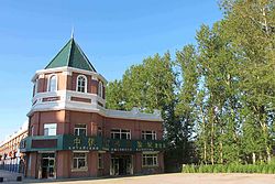
Wudalianchi
Jump to navigation
Jump to search
Wudalianchi
五大连池市 | |
|---|---|
 | |
| Coordinates: 48°45′N 126°10′E / 48.750°N 126.167°ECoordinates: 48°45′N 126°10′E / 48.750°N 126.167°E | |
| Country | People's Republic of China |
| Province | Heilongjiang |
| Prefecture-level city | Heihe |
| Time zone | UTC+8 (China Standard) |
| Postal code | 164100 |
| Area code | 0456 |
| Climate | Dwb |
| Website | www |
Wudalianchi (Chinese: 五大连池; pinyin: Wǔdàliánchí), formerly Dedu County (德都县), is a county-level city in Heilongjiang province, China. It is under the jurisdiction of the prefecture-level city of Heihe.
It contains a volcanic field.
The city's name means "five joint ponds" and refers to a set of interconnected lakes formed after the eruption of the volcanoes of Laoheishan (老黑山, means "Old Black Mountain") and Huoshaoshan (火烧山, means "Fire Burn Mountain") in 1720–21.[1][2]
The city is served by Wudalianchi Dedu Airport.
Administrative divisions
Wudalianchi City is divided into 1 subdistrict, 7 towns and 4 townships.[3]
- 1 subdistrict
- Qingshan (青山街道)
- 7 towns
- Long (龙镇), Heping (和平镇), Wudalianchi (五大连池镇), Shuangquan (双泉镇), Xinfa (新发镇), Tuanjie (团结镇), Xinglong (兴隆镇)
- 4 townships
Demographics
The population of the district was 355,397 in 1999.[4]
Climate
| Climate data for Wudalianchi (1981−2010) | |||||||||||||
|---|---|---|---|---|---|---|---|---|---|---|---|---|---|
| Month | Jan | Feb | Mar | Apr | May | Jun | Jul | Aug | Sep | Oct | Nov | Dec | Year |
| Record high °C (°F) | −4.0 (24.8) |
5.3 (41.5) |
19.6 (67.3) |
28.0 (82.4) |
35.3 (95.5) |
39.0 (102.2) |
36.5 (97.7) |
33.3 (91.9) |
35.1 (95.2) |
25.0 (77.0) |
11.9 (53.4) |
3.3 (37.9) |
39.0 (102.2) |
| Average high °C (°F) | −17.1 (1.2) |
−10.9 (12.4) |
−1.0 (30.2) |
10.9 (51.6) |
19.5 (67.1) |
25.0 (77.0) |
26.4 (79.5) |
24.7 (76.5) |
18.8 (65.8) |
9.1 (48.4) |
−4.6 (23.7) |
−15.0 (5.0) |
7.2 (44.9) |
| Daily mean °C (°F) | −23.1 (−9.6) |
−18.1 (−0.6) |
−7.5 (18.5) |
4.7 (40.5) |
12.8 (55.0) |
18.9 (66.0) |
21.2 (70.2) |
19.2 (66.6) |
12.5 (54.5) |
3.0 (37.4) |
−10.2 (13.6) |
−20.5 (−4.9) |
1.1 (33.9) |
| Average low °C (°F) | −28.3 (−18.9) |
−24.5 (−12.1) |
−14.0 (6.8) |
−1.5 (29.3) |
5.6 (42.1) |
12.4 (54.3) |
16.1 (61.0) |
14.1 (57.4) |
6.5 (43.7) |
−2.4 (27.7) |
−15.2 (4.6) |
−25.4 (−13.7) |
−4.7 (23.5) |
| Record low °C (°F) | −43.0 (−45.4) |
−43.6 (−46.5) |
−37.4 (−35.3) |
−14.3 (6.3) |
−6.1 (21.0) |
0.8 (33.4) |
8.3 (46.9) |
3.4 (38.1) |
−6.1 (21.0) |
−20.5 (−4.9) |
−33.5 (−28.3) |
−42.6 (−44.7) |
−43.6 (−46.5) |
| Average precipitation mm (inches) | 4.1 (0.16) |
3.5 (0.14) |
8.3 (0.33) |
25.2 (0.99) |
39.2 (1.54) |
84.3 (3.32) |
139.4 (5.49) |
111.4 (4.39) |
62.9 (2.48) |
26.1 (1.03) |
8.0 (0.31) |
6.7 (0.26) |
519.1 (20.44) |
| Average relative humidity (%) | 75 | 72 | 62 | 55 | 53 | 67 | 79 | 81 | 71 | 64 | 70 | 76 | 69 |
| Source: China Meteorological Data Service Center[5] | |||||||||||||
See also
References
- ^ "Wudalianchi". Global Volcanism Program. Smithsonian Institution. (五大连池火山群)
- ^ The Wudalianchi Scenic Spot
- ^ "国家统计局" (in Chinese). National Bureau of Statistics of the People's Republic of China. Retrieved 2021-12-07.
- ^ National Population Statistics Materials by County and City - 1999 Period, in China County & City Population 1999, Harvard China Historical GIS
- ^ 中国地面气候标准值月值(1981-2010) (in Simplified Chinese). China Meteorological Data Service Center. Retrieved 22 August 2022.
External links
![]() Media related to Wudalianchi at Wikimedia Commons
Media related to Wudalianchi at Wikimedia Commons
Categories:
- CS1 Chinese-language sources (zh)
- CS1 uses Chinese-language script (zh)
- CS1 Simplified Chinese-language sources (zh-hans)
- Articles with short description
- Short description with empty Wikidata description
- Articles containing Chinese-language text
- Coordinates not on Wikidata
- Articles containing simplified Chinese-language text
- Commons category link is the pagename
- AC with 0 elements
- County level divisions of Heilongjiang
- Cities in Heilongjiang
- Volcanoes of China
- Landforms of Heilongjiang
- Wudalianchi
- Heihe
- All stub articles
- Heilongjiang geography stubs

