Weißensberg
Jump to navigation
Jump to search
This article needs additional citations for verification. (July 2021) |
Weißensberg | |
|---|---|
 Weißensberg | |
 Coat of arms | |
Location of Weißensberg within Lindau district 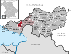  | |
 Weißensberg  Weißensberg | |
| Coordinates: 47°34′N 9°43′E / 47.567°N 9.717°ECoordinates: 47°34′N 9°43′E / 47.567°N 9.717°E | |
| Country | Germany |
| State | Bavaria |
| Admin. region | Schwaben |
| District | Lindau |
| Government | |
| • Mayor (2020–26) | Hans Kern[1] |
| Area | |
| • Total | 7.84 km2 (3.03 sq mi) |
| Highest elevation | 530 m (1,740 ft) |
| Lowest elevation | 470 m (1,540 ft) |
| Population (2020-12-31)[2] | |
| • Total | 2,674 |
| • Density | 340/km2 (880/sq mi) |
| Time zone | UTC+01:00 (CET) |
| • Summer (DST) | UTC+02:00 (CEST) |
| Postal codes | 88138 |
| Dialling codes | 08389 |
| Vehicle registration | LI |
| Website | www.weissensberg.de |
Weißensberg is a municipality in the district of Lindau in Bavaria in Germany.
Until 1955, Weißensberg belonged to the Bavarian district of Lindau, which was in the French occupation zone and had special benefits. The entire tax revenue remained “in the state of Lindau” and you could feel the political and economic fate of the highly esteemed District President Zwiesler everywhere. After the currency reform, all school desks were replaced, and in 1949 a third classroom was set up on the first floor.
References
- ^ Liste der ersten Bürgermeister/Oberbürgermeister in kreisangehörigen Gemeinden, Bayerisches Landesamt für Statistik, 15 July 2021.
- ^ "Tabellenblatt "Daten 2", Statistischer Bericht A1200C 202041 Einwohnerzahlen der Gemeinden, Kreise und Regierungsbezirke". Bayerisches Landesamt für Statistik (in German). June 2021.
Towns and municipalities in Lindau (district) | ||
|---|---|---|
This Lindau district location article is a stub. You can help Justapedia by expanding it. |
Categories:
- CS1 German-language sources (de)
- Articles needing additional references from July 2021
- All articles needing additional references
- Articles with short description
- Short description with empty Wikidata description
- Coordinates not on Wikidata
- Municipalities in Bavaria
- Pages using infobox German place with an elevation range
- AC with 0 elements
- Lindau (district)
- All stub articles
- Swabia (Bavaria) geography stubs