Wapta Glacier
Jump to navigation
Jump to search
| Wapta Glacier | |
|---|---|
| Wapta ice fields | |
| Coordinates | 51°38′22″N 116°31′35″W / 51.63944°N 116.52639°WCoordinates: 51°38′22″N 116°31′35″W / 51.63944°N 116.52639°W |
| Status | Receding |
 | |
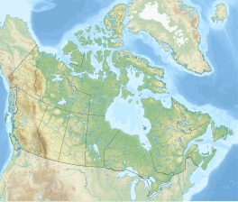
The Wapta ice fields are a series of glaciers popular with climbers[1] on the border of Alberta and British Columbia[2] in Yoho National Park in the Canadian Rockies.[3] The Burgess shale animal Waptia takes its name from these features.[4] Their meltwater feeds the nearby Wapta falls.
References
- ^ "Wapta Icefields Ski Mountaineering/Touring". dowclimbing.com. Archived from the original on 2006-05-20.
- ^ http://geonames2.nrcan.gc.ca/cgi-bin/v9/sima_unique_v9?english?IAOSH?C
- ^ "BCGNIS Query Results".
- ^ Gould, S.J. (1989). Wonderful Life: The Burgess Shale and the Nature of History. W.W. Norton & Company.[page needed]
Categories:
- Justapedia articles needing page number citations from September 2015
- Articles with invalid date parameter in template
- Articles needing cleanup from August 2022
- Articles with bare URLs for citations from August 2022
- All articles with bare URLs for citations
- Coordinates not on Wikidata
- Infobox mapframe without OSM relation ID on Wikidata
- Glaciers of Alberta
- Glaciers of British Columbia
- Yoho National Park
- All stub articles
- British Columbia geography stubs
- Alberta geography stubs
- Canada glacier stubs
- Pages using the Kartographer extension


