Te Whanga Lagoon
| Te Whanga Lagoon | |
|---|---|
 Te Whanga Lagoon | |
 The Chatham Islands from space | |
| Location | Chatham Island |
| Coordinates | 43°52′S 176°28′W / 43.867°S 176.467°WCoordinates: 43°52′S 176°28′W / 43.867°S 176.467°W |
| Basin countries | New Zealand |
| Surface area | 150 square kilometres (58 sq mi) |
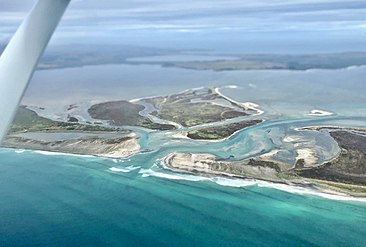
Te Whanga Lagoon dominates the geography of Chatham Island, in the South Pacific Ocean off New Zealand's east coast. It covers 160 square kilometres (62 sq mi).[1]
It is the outflow of several small rivers in the island's hilly south, and drains to the Pacific via gaps in Hanson Bay on the east coast of the island.
It contains many fossilized shark teeth that can be collected from the edges of the lagoon. Over time the lagoon is likely to silt up.[2]
When first described by Dr E Dieffenbach in 1841, the lagoon was only slightly brackish and separated from the sea by a low sand bar and was about 2 feet (0.61 m) above high tide.[3]
Gallery
Hikurangi Channel, Te Whanga Lagoon. This drainage channel was dug in the 1880s to give more farmland

Waikato Point. Cliffs rise to about 30 m (98 ft) on the west coast of the lagoon

Te Whanga Lagoon at Blind Jims Creek. 178m Korako is to the left, 149m Rangitihi and 188m Mt Chudleigh to the right.

Cattle Point, Te Whanga Lagoon


References
- ^ "Story: Chatham Islands". web page. The Encyclopedia of New Zealand. 7 September 2012. Retrieved 15 December 2012.
- ^ "Story: Chatham Islands". web page. The Encyclopedia of New Zealand. 7 September 2012. Retrieved 15 December 2012.
- ^ Williams, Gary (June 1995). "A Report on the Nature of Te Whanga Lagoon, and the Way in which it has Changed since 1840" (PDF).
{{cite web}}: CS1 maint: url-status (link)
| Islands (by English name) |  | |
|---|---|---|
| Islands (by Māori/Moriori name) | ||
| Coastal landforms | ||
| Populated places | ||
| Other geographic features | ||
| Historical events | ||
This article about the geography of New Zealand's outlying islands is a stub. You can help Justapedia by expanding it. |
- CS1 maint: url-status
- Articles with short description
- Short description with empty Wikidata description
- Use dmy dates from July 2019
- Coordinates not on Wikidata
- Articles using infobox body of water without image
- Landforms of the Chatham Islands
- Lagoons of New Zealand
- Chatham Island
- All stub articles
- New Zealand outlying island geography stubs