Tabas Airport
Jump to navigation
Jump to search
Tabas Airport فرودگاه طبس | |||||||||||
|---|---|---|---|---|---|---|---|---|---|---|---|
| Summary | |||||||||||
| Airport type | Public | ||||||||||
| Owner | Government of Iran | ||||||||||
| Operator | Iran Airports Company | ||||||||||
| Location | Tabas, Iran | ||||||||||
| Elevation AMSL | 2,312 ft / 705 m | ||||||||||
| Coordinates | 33°40′03″N 056°53′33″E / 33.66750°N 56.89250°E | ||||||||||
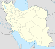
| Map | |||||||||||
| Runways | |||||||||||
| |||||||||||
Tabas Airport (Persian: فرودگاه طبس – Ferūdgāh-e Ţabas) (IATA: TCX[2], ICAO: OIMT[1]) is an airport serving Tabas,[3] a city in the South Khorasan Province of central Iran. For census purposes, it is a village in Montazeriyeh Rural District, in the Central District of Tabas County, South Khorasan Province. At the 2006 census, its population was 14, in 6 families.[4]
Airlines and destinations
| Airlines | Destinations |
|---|---|
| Mahan Air | Tehran–Mehrabad |
References
- ^ a b "Airport information for OIMT". World Aero Data. Archived from the original on 2019-03-05.
{{cite web}}: CS1 maint: unfit URL (link) Data current as of October 2006. Source: DAFIF. - ^ a b Airport information for TCX at Great Circle Mapper. Source: DAFIF (effective October 2006).
- ^ Tabas Airport (TCX/OIMT) - Tabas, Iran. Handbook of Business Aviation. Retrieved 16 July 2009.
- ^ "Census of the Islamic Republic of Iran, 1385 (2006)" (Excel). Statistical Center of Iran. Archived from the original on 2011-11-11.
External links
Categories:
- CS1 maint: unfit URL
- Articles with short description
- Short description with empty Wikidata description
- Articles containing Persian-language text
- AC with 0 elements
- Populated places in Tabas County
- Airports in Iran
- Buildings and structures in South Khorasan Province
- Transportation in South Khorasan Province
- All stub articles
- Iranian airport stubs
- Tabas County geography stubs
