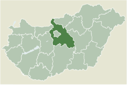
Tököl
Jump to navigation
Jump to search
Tököl | |
|---|---|
 The Chapel of St Anna | |
 | |
| Coordinates: 47°19′13″N 18°58′02″E / 47.32030°N 18.96711°ECoordinates: 47°19′13″N 18°58′02″E / 47.32030°N 18.96711°E | |
| Country | |
| County | Pest |
| Area | |
| • Total | 38.49 km2 (14.86 sq mi) |
| Population (2004) | |
| • Total | 9,337 |
| • Density | 242.58/km2 (628.3/sq mi) |
| Time zone | UTC+1 (CET) |
| • Summer (DST) | UTC+2 (CEST) |
| Postal code | 2316 |
| Area code | 24 |
Tököl (Serbo-Croatian: Tukulja) is a town in Pest County, Hungary.
Demography
The majority of residents are Hungarians, with a minority of Bunjevci.
Hungarian Uprising
An Budapest-Tököl airfield (47 20 35 N / 18 59 20 E) was built during World War II, which was to become a Soviet military base. During the Hungarian Uprising, Pál Maléter, as Defence Minister for the Imre Nagy government, went to negotiate with the Soviet military presence and was arrested during the negotiations.
Notable residents
- Pál Hoffman, politician
- István Szilágyi, handball player
Twin towns – sister cities
 Komádi – Hungary
 Constanța – Romania
 Manchester – United Kingdom
 Nitra – Slovakia
 Zakopane – Poland
 Klein Rönnau – Germany
 Umbria – Italy
 Viborg – Denmark
 Graz – Austria
 Karlshamn – Sweden
 Temerin – Serbia
 Kumanovo – North Macedonia
 Nin – Croatia
 2nd district of Budapest – Hungary
 Wageningen – Nederland
 Turnhout – Belgium
 Telšiai – Lithuania
 Zenica – Bosnia and Herzegovina
 Nõmme – Estonia
 Seseña – Spain
 Děčín – Czech Republic
 Queluz – Portugal
Planned partner city relations:
 Mioveni – Romania
 Bordeaux – France
 Parma – Italy
 Schaffhausen – Switzerland
 Strumica – North Macedonia
 Rîșcani – Moldova
 Randers – Denmark
 Talsi – Latvia
 Hamburg – Germany
 Cetinje – Montenegro
 Elbassan – Albania
 Shankill[disambiguation needed] – Ireland
 Nikopol – Bulgaria
 Nybro – Sweden
 Opava – Czech Republic
 Trondheim – Norway
External links
- Street map (in Hungarian)
Categories:
- Articles with short description
- Short description with empty Wikidata description
- Coordinates not on Wikidata
- Articles containing Serbo-Croatian-language text
- All articles with links needing disambiguation
- Articles with links needing disambiguation from March 2022
- Articles with Hungarian-language sources (hu)
- AC with 0 elements
- Populated places in Pest County
- Croatian communities in Hungary
- Serb communities in Hungary
- All stub articles
- Pest County geography stubs


