Situbondo Regency
This article needs additional citations for verification. (November 2014) |
Situbondo Regency
Kabupaten Situbondo | |
|---|---|
 Coat of arms | |
 Location within East Java | |
| Coordinates: 7°42′S 114°00′E / 7.700°S 114.000°ECoordinates: 7°42′S 114°00′E / 7.700°S 114.000°E | |
| Country | |
| Province | East Java |
| Capital | Situbondo |
| Government | |
| • Regent | Karna Suswandi |
| • Vice Regent | HJ.Khoirani |
| Area | |
| • Total | 1,638.50 km2 (632.63 sq mi) |
| Population (2020 Census)[1] | |
| • Total | 685,967 |
| • Density | 420/km2 (1,100/sq mi) |
| Time zone | UTC+7 (IWST) |
| Area code | (+62) 338 |
| Website | situbondokab |


Situbondo Regency is a regency (kabupaten) of East Java province, Indonesia. It covers an area of 1,638.50 km2, and had a population of 647,619 at the 2010 Census[2] and 685,967 at the 2020 Census.[3] It is located in east end of Java before Banyuwangi. The administrative centre is Situbondo, a small town within the regency. One of the famous tourist sites is Baluran National Park.
Administrative districts
The Regency is divided into seventeen districts (kecamatan), tabulated below with their areas and their population totals from the 2010 Census[4] and the 2020 Census.[5] The table also includes the location of the district headquarters and the number of administrative villages (rural desa and urban kelurahan) in each district.
| Name | Area in km2 |
Pop'n Census 2010[6] |
Pop'n Census 2020[7] |
Admin centre |
Number of villages |
|---|---|---|---|---|---|
| Sumbermalang | 129.47 | 26,319 | 28,466 | Tlogosari | 9 |
| Jatibanteng | 66.08 | 21,847 | 23,083 | Jatibanteng | 8 |
| Banyuglugur | 72.66 | 22,443 | 24,583 | Banyuglugur | 7 |
| Besuki | 26.41 | 61,211 | 65,110 | Besuki | 10 |
| Suboh | 30.84 | 26,186 | 28,178 | Buduan | 8 |
| Mlandingan | 39.61 | 22,371 | 23,809 | Mlandingan Kulon | 7 |
| Bungatan | 66.07 | 24,417 | 25,982 | Bungatan | 7 |
| Kendit | 114.14 | 28,172 | 29,310 | Kendit | 7 |
| Panarukan | 54.38 | 53,034 | 58,315 | Wringin Anom | 8 |
| Situbondo | 27.81 | 46,854 | 48,656 | Patokan | 6 |
| Mangaran | 35.70 | 31,937 | 34,181 | Mangaran | 6 |
| Panji | 46.99 | 68,286 | 66,926 | Mimbaan | 12 |
| Kapongan | 44.55 | 36,990 | 38,939 | Kesambi Rampak | 10 |
| Arjasa | 216.38 | 39,708 | 43,637 | Arjasa | 8 |
| Jangkar | 67.00 | 36,321 | 41,012 | Jangkar | 8 |
| Asembagus | 118.74 | 47,256 | 49,661 | Asembagus | 10 |
| Banyuputih | 481.67 | 54,267 | 56,119 | Sumberanyar | 5 |
| Totals | 1,638.50 | 647,619 | 685,967 | Situbondo | 136 |
Climate
Situbondo has a tropical savanna climate (Aw) with heavy rainfall from December to March and moderate to little rainfall from April to November.
| Climate data for Situbondo | |||||||||||||
|---|---|---|---|---|---|---|---|---|---|---|---|---|---|
| Month | Jan | Feb | Mar | Apr | May | Jun | Jul | Aug | Sep | Oct | Nov | Dec | Year |
| Average high °C (°F) | 31.1 (88.0) |
31.1 (88.0) |
31.3 (88.3) |
31.7 (89.1) |
31.7 (89.1) |
31.6 (88.9) |
31.5 (88.7) |
31.9 (89.4) |
33.0 (91.4) |
33.6 (92.5) |
33.2 (91.8) |
31.9 (89.4) |
32.0 (89.6) |
| Daily mean °C (°F) | 26.0 (78.8) |
26.0 (78.8) |
26.1 (79.0) |
26.4 (79.5) |
26.3 (79.3) |
25.9 (78.6) |
25.4 (77.7) |
25.8 (78.4) |
26.6 (79.9) |
27.2 (81.0) |
27.2 (81.0) |
26.5 (79.7) |
26.3 (79.3) |
| Average low °C (°F) | 20.9 (69.6) |
21.0 (69.8) |
21.0 (69.8) |
21.2 (70.2) |
20.9 (69.6) |
20.2 (68.4) |
19.3 (66.7) |
19.7 (67.5) |
20.2 (68.4) |
20.8 (69.4) |
21.2 (70.2) |
21.1 (70.0) |
20.6 (69.1) |
| Average rainfall mm (inches) | 281 (11.1) |
243 (9.6) |
193 (7.6) |
77 (3.0) |
64 (2.5) |
35 (1.4) |
20 (0.8) |
6 (0.2) |
4 (0.2) |
18 (0.7) |
67 (2.6) |
187 (7.4) |
1,195 (47.1) |
| Source: Climate-Data.org[8] | |||||||||||||
History
This section is empty. You can help by adding to it. (June 2020) |
Demographic Information
This section is empty. You can help by adding to it. (June 2020) |
Future Projects
This section is empty. You can help by adding to it. (June 2020) |
Gallery


Two groups of men under a large banyan tree in Situbondo
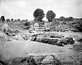
River and washed away bridge in the area of Situbondo


References
- ^ Badan Pusat Statistik, Jakarta, 2021.
- ^ Biro Pusat Statistik, Jakarta, 2011.
- ^ Badan Pusat Statistik, Jakarta, 2021.
- ^ Biro Pusat Statistik, Jakarta, 2011.
- ^ Badan Pusat Statistik, Jakarta, 2021.
- ^ Biro Pusat Statistik, Jakarta, 2011.
- ^ Badan Pusat Statistik, Jakarta, 2021.
- ^ "Climate: Situbondo". Climate-Data.org. Retrieved 10 November 2020.

This East Java location article is a stub. You can help Justapedia by expanding it. |
- Articles needing additional references from November 2014
- All articles needing additional references
- Articles with short description
- Coordinates not on Wikidata
- Articles to be expanded from June 2020
- All articles to be expanded
- Articles with empty sections from June 2020
- All articles with empty sections
- Articles using small message boxes
- AC with 0 elements
- Situbondo Regency
- All stub articles
- East Java geography stubs