Sena, New Mexico
Jump to navigation
Jump to search
Sena, New Mexico | |
|---|---|
 Sena Location within the state of New Mexico | |
| Coordinates: 35°17′54″N 105°21′34″W / 35.29833°N 105.35944°WCoordinates: 35°17′54″N 105°21′34″W / 35.29833°N 105.35944°W[1] | |
| Country | United States |
| State | New Mexico |
| County | San Miguel |
| Area | |
| • Total | 2.13 sq mi (5.51 km2) |
| • Land | 2.13 sq mi (5.51 km2) |
| • Water | 0.00 sq mi (0.00 km2) |
| Elevation | 5,876 ft (1,791 m) |
| Population | |
| • Total | 155 |
| • Density | 72.91/sq mi (28.15/km2) |
| Time zone | UTC-7 (MST) |
| • Summer (DST) | UTC-6 (MDT) |
| Area code | 505 |
| FIPS code | 35-71790 [1] |
| GNIS ID | 910937 [1] |
Sena is an unincorporated community and census-designated place in San Miguel County, New Mexico, United States.[1] It is located along the Pecos River and New Mexico State Highway 3.
Demographics
| Historical population | |||
|---|---|---|---|
| Census | Pop. | %± | |
| 2020 | 155 | — | |
| U.S. Decennial Census[4][3] | |||
History
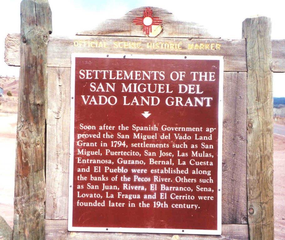
Sena was founded in the 19th century.[5]
Economy
Sena has no commercial enterprises of its own. The nearest store and Post Office is 3.2 miles (5.1 km) southeast, in the community of Villanueva.
Education
It is in the West Las Vegas Schools school district.[6] West Las Vegas High School is the area high school.
See also
References
- ^ a b c d e Geographic Names Information System (GNIS) details for Sena, New Mexico; United States Geological Survey (USGS); November 13, 1980.
- ^ "ArcGIS REST Services Directory". United States Census Bureau. Retrieved October 12, 2022.
- ^ a b "Census Population API". United States Census Bureau. Retrieved Oct 12, 2022.
- ^ "Census of Population and Housing". Census.gov. Retrieved June 4, 2016.
- ^ Settlements of the San Miguel Del Vado Land Grant; Official Scenic Historic Marker.
- ^ "2020 CENSUS - SCHOOL DISTRICT REFERENCE MAP: San Miguel County, NM" (PDF). U.S. Census Bureau. Retrieved 2022-07-12.
External links
Municipalities and communities of San Miguel County, New Mexico, United States | ||
|---|---|---|
| City |  | |
| Villages | ||
| CDPs | ||
| Other communities | ||
| Ghost towns | ||
| Footnotes | ‡This populated place also has portions in an adjacent county or counties | |
This New Mexico state location article is a stub. You can help Justapedia by expanding it. |
Categories:
- Articles with short description
- Short description with empty Wikidata description
- Coordinates not on Wikidata
- Articles needing additional references from December 2020
- All articles needing additional references
- AC with 0 elements
- Census-designated places in New Mexico
- Census-designated places in San Miguel County, New Mexico
- Unincorporated communities in New Mexico
- Unincorporated communities in San Miguel County, New Mexico
- All stub articles
- New Mexico geography stubs