Saldenburg
Jump to navigation
Jump to search
This article may be expanded with text translated from the corresponding article in German. (March 2009) Click [show] for important translation instructions.
|
Saldenburg | |
|---|---|
 Town hall | |
 Coat of arms | |
Location of Saldenburg within Freyung-Grafenau district 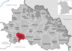  | |
 Saldenburg  Saldenburg | |
| Coordinates: 48°47′N 13°21′E / 48.783°N 13.350°ECoordinates: 48°47′N 13°21′E / 48.783°N 13.350°E | |
| Country | Germany |
| State | Bavaria |
| Admin. region | Niederbayern |
| District | Freyung-Grafenau |
| Government | |
| • Mayor (2020–26) | Max König[1] (SPD) |
| Area | |
| • Total | 28.04 km2 (10.83 sq mi) |
| Highest elevation | 570 m (1,870 ft) |
| Lowest elevation | 450 m (1,480 ft) |
| Population (2020-12-31)[2] | |
| • Total | 2,024 |
| • Density | 72/km2 (190/sq mi) |
| Time zone | UTC+01:00 (CET) |
| • Summer (DST) | UTC+02:00 (CEST) |
| Postal codes | 94163 |
| Dialling codes | 08504 |
| Vehicle registration | FRG |
| Website | www.saldenburg.de |
Saldenburg is a municipality in the district of Freyung-Grafenau in Bavaria in Germany.
The municipality comprises the following 30 villages and locations:
|
References
- ^ Liste der ersten Bürgermeister/Oberbürgermeister in kreisangehörigen Gemeinden, Bayerisches Landesamt für Statistik, 15 July 2021.
- ^ "Tabellenblatt "Daten 2", Statistischer Bericht A1200C 202041 Einwohnerzahlen der Gemeinden, Kreise und Regierungsbezirke". Bayerisches Landesamt für Statistik (in German). June 2021.
Wikimedia Commons has media related to Saldenburg.
Towns and municipalities in Freyung-Grafenau | ||
|---|---|---|
This Freyung-Grafenau location article is a stub. You can help Justapedia by expanding it. |
Categories:
- CS1 German-language sources (de)
- Geography articles needing translation from German Wikipedia
- Articles with short description
- Short description with empty Wikidata description
- Coordinates not on Wikidata
- Municipalities in Bavaria
- Pages using infobox German place with an elevation range
- Commons category link is the pagename
- AC with 0 elements
- Freyung-Grafenau
- All stub articles
- Lower Bavaria geography stubs