Coipasa Lake
(Redirected from Salar de Coipasa)
| Lago Coipasa | |
|---|---|
 | |
 Coipasa Lake  Coipasa Lake | |
| Location | Sabaya Province, Oruro Department |
| Coordinates | 19°12′S 68°07′W / 19.200°S 68.117°WCoordinates: 19°12′S 68°07′W / 19.200°S 68.117°W |
| Primary inflows | Río Lauca |
| Basin countries | Bolivia |
| Surface area | 806 km2 (311 sq mi) |
| Max. depth | 3.5 m (11 ft) |
| Surface elevation | 3,657 m (11,998 ft) |
 | |
Lago Coipasa or Salar de Coipasa is a lake in Sabaya Province, Oruro Department, Bolivia. At an elevation of 3657 m, its surface area is 806 km². It is on the western part of Altiplano, 20 km north of Salar de Uyuni and south of the main road linking Oruro and Huara (Chile).[1]
Lake Coipasa is a tectonic[clarification needed] saline lake with a depth of 3.5 metres that is surrounded by the Coipasa salt flat (Salar de Coipasa), and the volcanic cone of Wila Pukarani.
Thousands of flamingos have settled on the shores of Lake Coipasa.

Gallery

Map of the shape and depth (bathymetry) of the Coipasa lake, 2020

The lake
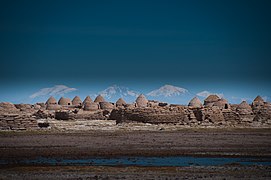
The village of Chipaya, Oruro, Bolivia, near the lake
_2020.jpg)


See also
References
- ^ "Travel map of the Andes". Nelles Map. Archived from the original on 2010-09-24. Retrieved 2010-12-10.
External links
 Media related to Salar de Coipasa at Wikimedia Commons
- Salar de Coipasa (Map). Archived from the original on 31 May 2014. Retrieved 31 May 2014.
- www
.boliviatravelsite .com /attractions .php?attraction=Coipasa+Lake - gsabulletin
.gsapubs .org /content /118 /5-6 /515 .abstract
Categories:
- Articles with short description
- Coordinates not on Wikidata
- Infobox mapframe without OSM relation ID on Wikidata
- Articles using infobox body of water without alt
- Articles using infobox body of water without image bathymetry
- Justapedia articles needing clarification from April 2019
- Articles with invalid date parameter in template
- AC with 0 elements
- All stub articles
- Oruro Department geography stubs
- Lakes of Oruro Department
- Salt flats of Bolivia
- Saline lakes of South America
- Endorheic lakes of South America
- Landforms of Oruro Department
- Pages using the Kartographer extension