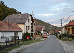
Répáshuta
Jump to navigation
Jump to search
This article may be expanded with text translated from the corresponding article in Hungarian. (December 2009) Click [show] for important translation instructions.
|
Répáshuta
Repašská Huta (in Slovak) | |
|---|---|
Village | |
 | |
| Coordinates: 48°02′55″N 20°31′41″E / 48.04875°N 20.528169°ECoordinates: 48°02′55″N 20°31′41″E / 48.04875°N 20.528169°E | |
| Country | Hungary |
| Region | Northern Hungary |
| County | Borsod-Abaúj-Zemplén |
| District | Miskolc |
| Area | |
| • Total | 16.79 km2 (6.48 sq mi) |
| Time zone | UTC+1 (CET) |
| • Summer (DST) | UTC+2 (CEST) |
| Postal code | 3559 |
| Area code | (+36) 46 |
| Website | www |
Répáshuta is a village in Borsod-Abaúj-Zemplén County in northeastern Hungary.[1]
References
- ^ Központi Statisztikai Hivatal (KSH) (in Hungarian)
Categories:
- Articles with Hungarian-language sources (hu)
- Geography articles needing translation from Hungarian Wikipedia
- Articles with short description
- Short description with empty Wikidata description
- Articles containing Slovak-language text
- Articles with Slovak-language sources (sk)
- Coordinates not on Wikidata
- AC with 0 elements
- Populated places in Borsod-Abaúj-Zemplén County
- All stub articles
- Borsod-Abaúj-Zemplén geography stubs


