Quebec Route 219
 | ||||
|---|---|---|---|---|
 | ||||
| Route information | ||||
| Maintained by Transports Québec | ||||
| Length | 55.0 km[1] (34.2 mi) | |||
| Major junctions | ||||
| South end | CR 34 at the United States border in Hemmingford Township | |||
| North end | ||||
| Location | ||||
| Country | Canada | |||
| Province | Quebec | |||
| Highway system | ||||
| ||||
Route 219 is a provincial highway located in the Montérégie region of Quebec south of Montreal. It starts at the Mooers-Hemmingford Border Crossing south of Hemmingford and ends in Saint-Jean-sur-Richelieu.
The highway starts at the border continuing from the former north terminus of NY 22 south of Hemmingford and north of Mooers, New York, from there it goes North through the Village and Township of Hemmingford toward Saint-Patrice-de-Sherrington. There it turns east for a 9 km concurrency with Route 221 until Napierville, where again it goes north alongside the L'Acadie River until reaching the former municipality of L'Acadie, where it turns eastward toward its terminus at a junction with Autoroute 35 in Saint-Jean-sur-Richelieu.
Municipalities along Route 219
- Hemmingford Township
- Hemmingford Village
- Saint-Patrice-de-Sherrington
- Saint-Cyprien-de-Napierville
- Napierville
- Saint-Jean-sur-Richelieu
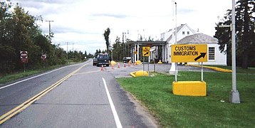
Mooers border station, southern terminus of Route 219.

Route 219 begins at Hemmingford border crossing.


Major intersections
| RCM | Location | km | mi | Destinations | Notes |
|---|---|---|---|---|---|
| Les Jardins-de-Napierville | Hemmingford | 0 | 0.0 | Southern terminus | |
| Southern terminus of Route 205 | |||||
| Saint-Patrice-de-Sherrington | Begin/end concurrency with Route 221 | ||||
| Saint-Cyprien-de-Napierville | Exit 21 (A-15) | ||||
| Napierville | Begin/end concurrency with Route 221 | ||||
| Le Haut-Richelieu | Saint-Jean-sur-Richelieu | 55 | 34 | Exit 45 (A-35 / QC 104); northern terminus | |
| 1.000 mi = 1.609 km; 1.000 km = 0.621 mi | |||||
See also
References
- ^ Ministère des transports, "Distances routières", page 83, Les Publications du Québec, 2005
External links
- Official Transport Quebec Road Map (in French)
- Route 219 on Google Maps
This Quebec road, road transport or highway-related article is a stub. You can help Justapedia by expanding it. |
- Infobox road maps tracking category
- Infobox road maps for Wikidata migration
- Infobox road articles without wikidata country
- Infobox road articles without wikidata instance of
- Infobox road instances in Quebec
- Articles with French-language sources (fr)
- Quebec Routes
- Transport in Saint-Jean-sur-Richelieu
- All stub articles
- Quebec road stubs