Puerto Rico Highway 744
Jump to navigation
Jump to search
Highway 744 | ||||
|---|---|---|---|---|
| Ruta 744 | ||||
| Route information | ||||
| Maintained by Puerto Rico DTPW | ||||
| Length | 2.7 km[1] (1.7 mi) | |||
| Major junctions | ||||
| South end | Sector Central Machete in Machete | |||
| North end | ||||
| Location | ||||
| Country | United States | |||
| Territory | Puerto Rico | |||
| Municipalities | Guayama | |||
| Highway system | ||||
| ||||

Puerto Rico Highway 744 (PR-744) is a north–south road located entirely in the municipality of Guayama, Puerto Rico.[2] With a length of 2.7 kilometers (1.7 mi),[1] it begins at its intersection with PR-3 in downtown Guayama[3] and ends at Sector Central Machete in Machete barrio.[4]
Major intersections
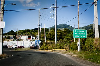
PR-744 approaching PR-54 junction

The entire route is located in Guayama.
| Location | km[1] | mi | Destinations | Notes | |
|---|---|---|---|---|---|
| Machete | 2.7 | 1.7 | PR-Sector Central Machete – Guayama | Southern terminus of PR-744 | |
| Guayama barrio-pueblo | 0.6 | 0.37 | |||
| 0.0 | 0.0 | Northern terminus of PR-744 | |||
| 1.000 mi = 1.609 km; 1.000 km = 0.621 mi | |||||
See also
References
- ^ a b c Google (14 August 2020). "PR-744" (Map). Google Maps. Google. Retrieved 14 August 2020.
- ^ National Geographic Maps (2011). Puerto Rico (Map). 1:125,000. Adventure Map (Book 3107). Evergreen, Colorado: National Geographic Maps. ISBN 978-1566955188. OCLC 756511572.
- ^ "Tránsito Promedio Diario (AADT)". Transit Data (Datos de Tránsito) (in Spanish). Puerto Rico Department of Transportation and Public Works. p. 127. Retrieved 14 August 2020.
- ^ "PR-744, Guayama, Puerto Rico". geoview.info. Retrieved 14 August 2020.
External links
 Media related to Puerto Rico Highway 744 at Wikimedia Commons
This Puerto Rico road-related article is a stub. You can help Justapedia by expanding it. |
Categories:
- CS1 Spanish-language sources (es)
- Articles with short description
- Use dmy dates from August 2020
- Articles containing Spanish-language text
- Infobox road maps tracking category
- Infobox road articles without wikidata country
- Infobox road articles without wikidata instance of
- Infobox road instances in Puerto Rico
- Commons category link is the pagename
- Highways in Puerto Rico
- Guayama, Puerto Rico
- All stub articles
- Puerto Rico road stubs