Ngukurr Airport
Jump to navigation
Jump to search
This article needs additional citations for verification. (June 2021) |
Ngukurr Airport | |||||||||||
|---|---|---|---|---|---|---|---|---|---|---|---|
| Summary | |||||||||||
| Airport type | Public | ||||||||||
| Operator | Yugul Mangi Community Government Council | ||||||||||
| Location | Roper River, Northern Territory, Australia | ||||||||||
| Elevation AMSL | 45 ft / 14 m | ||||||||||
| Coordinates | 14°43′22″S 134°44′51″E / 14.72278°S 134.74750°ECoordinates: 14°43′22″S 134°44′51″E / 14.72278°S 134.74750°E | ||||||||||
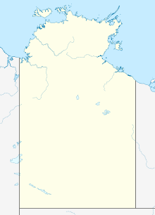
| Map | |||||||||||
| Runways | |||||||||||
| |||||||||||
Ngukurr Airport (IATA: RPM, ICAO: YNGU) is located in Roper River, Northern Territory, Australia, adjacent to the remote Aboriginal community of Ngukurr.
Airlines and destinations
| Airlines | Destinations |
|---|---|
| Mission Aviation Fellowship | Darwin, Gove |
See also
References
- ^ YNGU – Ngukurr (PDF). AIP En Route Supplement from Airservices Australia, effective 2022-09-22, Aeronautical Chart
External links
Categories:
- Articles with short description
- Short description with empty Wikidata description
- Use dmy dates from May 2013
- Use Australian English from May 2013
- All Wikipedia articles written in Australian English
- Articles needing additional references from June 2021
- All articles needing additional references
- Coordinates not on Wikidata
- AC with 0 elements
- Airports in the Northern Territory
- All stub articles
- Australian airport stubs
- Northern Territory stubs
