Ming-Kush Valley
Jump to navigation
Jump to search
| Ming-Kush Valley | |
|---|---|
| Length | 30 km (19 mi) |
| Width | 2 km (1.2 mi) |
| Geography | |
| Coordinates | 41°40′N 74°29′E / 41.667°N 74.483°ECoordinates: 41°40′N 74°29′E / 41.667°N 74.483°E |
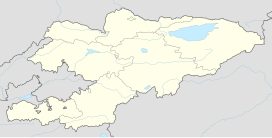
The Ming-Kush Valley (Kyrgyz: Миңкуш өрөөнү) is a valley located in central Kyrgyzstan.[1] It is separated from the Naryn river valley to the south by the Moldo Too range. The Kabak Too range lies to its north. The valley is 30 km (19 mi) long and 2 km (1.2 mi) wide.[2] The river Ming-Kush (a left tributary of the Kökömeren) flows through it, and the main settlement is the village Ming-Kush. Coal deposits in the valley have been exploited since the 1950s.[3]
References
- ^ "Valleys".
- ^ "Миңкуш өрөөнү" [Ming-Kush Valley] (PDF). Кыргызстандын Географиясы [Geography of Kyrgyzstan] (in Kyrgyz). Bishkek. 2004. p. 115.
- ^ "Миңкуш ташкөмүр кендеринин тобу" [Ming-Kush group of coal deposits] (PDF). Кыргызстандын Географиясы [Geography of Kyrgyzstan] (in Kyrgyz). Bishkek. 2004. p. 161.
