Maranguape
Jump to navigation
Jump to search
Maranguape | |
|---|---|
 Municipal office | |
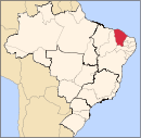
 Location in Ceará state | |
| Coordinates: 3°53′24″S 38°41′9″W / 3.89000°S 38.68583°WCoordinates: 3°53′24″S 38°41′9″W / 3.89000°S 38.68583°W | |
| Country | Brazil |
| Region | Northeast |
| State | Ceará |
| Area | |
| • Total | 590.873 km2 (228.137 sq mi) |
| Elevation | 68 m (223 ft) |
| Population (2020 est.[2]) | |
| • Total | 130,346 |
| • Density | 220/km2 (570/sq mi) |
| Time zone | UTC−3 (BRT) |
| Website | http://www.maranguape.ce.gov.br/ |
Maranguape is a municipality in Ceará with a population of 130,346 (2020). The community was founded in 1851. It is part of the Fortaleza metropolitan area.
Notable natives
- Capistrano de Abreu - Brazilian historian.
- Chico Anysio - Brazilian comedian.
- Roberta Marques - Brazilian cineast.
- Lupe Gigliotti - Brazilian actress.
References
- ^ "Brazilian Institute of Geography and Statistics" (in Portuguese). 2017. Retrieved 27 March 2019.
2018 Area Total
- ^ IBGE 2020


