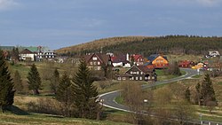
Malá Úpa
Jump to navigation
Jump to search
Malá Úpa | |
|---|---|
 General view | |
| Coordinates: 50°43′26″N 15°48′50″E / 50.72389°N 15.81389°ECoordinates: 50°43′26″N 15°48′50″E / 50.72389°N 15.81389°E | |
| Country | |
| Region | Hradec Králové |
| District | Trutnov |
| First mentioned | 1748 |
| Area | |
| • Total | 26.67 km2 (10.30 sq mi) |
| Elevation | 1,041 m (3,415 ft) |
| Population (2022-01-01)[1] | |
| • Total | 144 |
| • Density | 5.4/km2 (14/sq mi) |
| Time zone | UTC+1 (CET) |
| • Summer (DST) | UTC+2 (CEST) |
| Postal code | 542 27 |
| Website | malaupa |
Malá Úpa (German: Kleinaupa) is a municipality and village in Trutnov District in the Hradec Králové Region of the Czech Republic. It has about 100 inhabitants.
Geography
Malá Úpa lies in the Giant Mountains. It is located on the border with Poland. There is a road border crossing.
Twin towns – sister cities
 Kowary, Poland
References
- ^ "Population of Municipalities – 1 January 2022". Czech Statistical Office. 2022-04-29.
- ^ "Raport o stanie miasta Kowary" (in Polish). Biuletyn Informacji Publicznej Miasta Kowary. 2018. p. 128. Retrieved 2021-09-24.
Wikimedia Commons has media related to Malá Úpa.
Categories:
- CS1 Polish-language sources (pl)
- Articles with short description
- Short description with empty Wikidata description
- Coordinates not on Wikidata
- Articles containing German-language text
- Commons category link is defined as the pagename
- Populated places in Trutnov District
- AC with 0 elements
- Villages in Trutnov District
- All stub articles
- Hradec Králové Region geography stubs


