Maillebois
Jump to navigation
Jump to search
Maillebois | |
|---|---|
 The chateau in Maillebois | |
 Coat of arms | |
 Maillebois  Maillebois | |
| Coordinates: 48°37′48″N 1°08′57″E / 48.63°N 1.1492°ECoordinates: 48°37′48″N 1°08′57″E / 48.63°N 1.1492°E | |
| Country | France |
| Region | Centre-Val de Loire |
| Department | Eure-et-Loir |
| Arrondissement | Dreux |
| Canton | Saint-Lubin-des-Joncherets |
| Intercommunality | CA Pays de Dreux |
| Government | |
| • Mayor (2020–2026) | Arnaud de Boisanger[1] |
| Area 1 | 41 km2 (16 sq mi) |
| Time zone | UTC+01:00 (CET) |
| • Summer (DST) | UTC+02:00 (CEST) |
| INSEE/Postal code | 28226 /28170 |
| Elevation | 137–191 m (449–627 ft) (avg. 165 m or 541 ft) |
| 1 French Land Register data, which excludes lakes, ponds, glaciers > 1 km2 (0.386 sq mi or 247 acres) and river estuaries. | |
Maillebois (French pronunciation: [majbwa]) is a commune in the Eure-et-Loir department in northern France. The Blaise, a tributary of the Eure, runs through the town.
Population
| Year | Pop. | ±% |
|---|---|---|
| 1962 | 1,040 | — |
| 1968 | 770 | −26.0% |
| 1975 | 843 | +9.5% |
| 1982 | 828 | −1.8% |
| 1990 | 821 | −0.8% |
| 1999 | 917 | +11.7% |
| 2008 | 990 | +8.0% |
| 2016 | 930 | −6.1% |
Places of interest
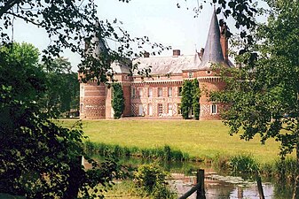
- Chateau de Maillebois, a registered monument[2]
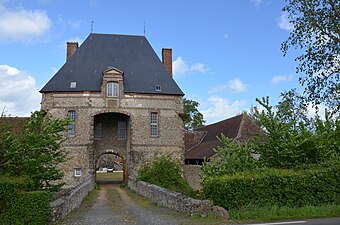
- Rouvray farm, a former Chateau Fort (which is a fortified building, like a fortress, but often also a practical building) and registered monument.[3] It was a fort during the Hundred Years' War.
- Les Forges de Dampierre-sur-Blévy, a former foundry and a registered monument[4]
- Dreux-Louvilliers Air Base is a former United States Air Force base near Maillebois
Famous residents
- Jean-Baptiste Francois des Marets, marquis of Maillebois, was a Marshal of France.
- Paul-Félix Armand-Delille, bacteriologist who introduced the myxomatosis virus in his estate of the château.
- Hubert Latham lived in the Chateau de Maillebois (the family home)
See also
Gallery
Rouvray farm
Chateau de Maillebois
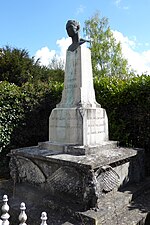
Bust of Hubert Latham in the town centre.

Aerial photograph of Dreux-Louvilliers Air Base
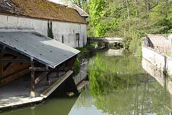
The Blaise in Maillebois


.jpg)

.jpg)
References
- ^ "Répertoire national des élus: les maires". data.gouv.fr, Plateforme ouverte des données publiques françaises (in French). 9 August 2021.
- ^ Base Mérimée: Chateau de Maillebois, Ministère français de la Culture. (in French)
- ^ Base Mérimée: Rouvray farm, Ministère français de la Culture. (in French)
- ^ Base Mérimée: Les Forges de Dampierre-sur-Blévy, Ministère français de la Culture. (in French)
External links
Wikimedia Commons has media related to Maillebois.
This Eure-et-Loir geographical article is a stub. You can help Justapedia by expanding it. |
Categories:
- CS1 French-language sources (fr)
- Articles with French-language sources (fr)
- Articles with short description
- Short description with empty Wikidata description
- Coordinates not on Wikidata
- France articles requiring maintenance
- Commons category link is the pagename
- AC with 0 elements
- Communes of Eure-et-Loir
- All stub articles
- Eure-et-Loir geography stubs