Mahambo
Jump to navigation
Jump to search
Mahambo | |
|---|---|
 beach at Mahambo | |
| Coordinates: 17°29′S 49°28′E / 17.483°S 49.467°E | |
| Country | |
| Region | Analanjirofo |
| District | Fenerive Est |
| Area | |
| • Total | 278 km2 (107 sq mi) |
| Elevation | 13 m (43 ft) |
| Population (2001)[3] | |
| • Total | 26,000 |
| Time zone | UTC3 (EAT) |
| Postal code | 509 |
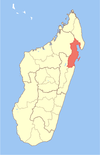
Mahambo is a town and commune (Malagasy: kaominina) in Madagascar. It belongs to the district of Fenerive Est, which is a part of Analanjirofo Region. The population of the commune was estimated to be approximately 26,000 in 2001 commune census.[3]
Primary and junior level secondary education are available in town. The majority 80% of the population of the commune are farmers. The most important crops are rice and bananas, while other important agricultural products are cloves and lychee. Services provide employment for 17% of the population. Additionally fishing employs 3% of the population.[3]
Rivers[edit]
Mahambo lies at the river Iazafo.
References[edit]
- ^ ioniala.org
- ^ Estimated based on DEM data from Shuttle Radar Topography Mission
- ^ a b c "ILO census data". Cornell University. 2002. Retrieved 2008-03-07.
Wikimedia Commons has media related to Mahambo.
Coordinates: 17°29′S 49°28′E / 17.483°S 49.467°E

