Lower Silesian Forest
| Lower Silesian Forest Polish: Bory Dolnośląskie | |
|---|---|
 Lower Silesian Forest is predominantly made of pine trees | |
| Map | |
 | |
| Geography | |
| Location | Lower Silesian Voivodeship, Lubusz Voivodeship, Poland |
| Coordinates | 51°22′14″N 15°07′13″E / 51.3705°N 15.1204°ECoordinates: 51°22′14″N 15°07′13″E / 51.3705°N 15.1204°E |
Lower Silesian Forest (Polish: Bory Dolnośląskie, German: Niederschlesische Heide) is the largest continuous forest of Poland, with total area of 1650 square kilometers. It is located in southwestern Poland, in the Lower Silesian Voivodeship and the Lubusz Voivodeship, near border with Germany. Western boundary of the forest is made by the Nysa Łużycka, behind which spreads a German forest, Muskauer Heide. It is mostly covered by pine trees.
The area of the Lower Silesian Forest is predominantly flat, with the biggest point, the hill called Dębniak measuring only 238 meters above sea level. The wilderness is subdivided into several smaller forests, and it is crossed by a number of rivers, including the Kwisa, the Bóbr, and the Szprotawa. Among most important urban centers in this region are Bolesławiec, Węgliniec, Żagań, Żary, Szprotawa, and Pieńsk.
The Lower Silesian Forest is very popular among hunters, as it is rich in such animals as deer, wild pigs, hares, foxes, and wolves.
Gallery
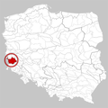
Location within Poland

Forest near Ruszów
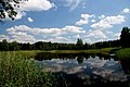
Pond in Żagań

German bunker from World War II near Szprotawa


See also
This Poland location article is a stub. You can help Justapedia by expanding it. |
- Articles with short description
- Short description with empty Wikidata description
- Articles containing Polish-language text
- Coordinates not on Wikidata
- Articles containing German-language text
- All stub articles
- Poland geography stubs
- Forests of Poland
- Geography of Lubusz Voivodeship
- Geography of Lower Silesian Voivodeship
- Tourist attractions in Lower Silesian Voivodeship
- Lower Silesia