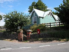
Llanddewi Skirrid
| Llanddewi Skirrid | |
|---|---|
 Llanddewi Skirrid Village Hall | |
Location within Monmouthshire | |
| Principal area | |
| Ceremonial county | |
| Country | Wales |
| Sovereign state | United Kingdom |
| Post town | USK |
| Postcode district | NP |
| Police | Gwent |
| Fire | South Wales |
| Ambulance | Welsh |
| UK Parliament | |
Llanddewi Skirrid (Welsh: Llanddewi Ysgyryd) is a village in Monmouthshire, south east Wales, United Kingdom.
Location
Llanddewi Skirrid is located 3 miles (4.8 km) north east of Abergavenny on the old B4521 road to Ross-on-Wye.[1]
History and amenities
The Skirrid mountain overlooks the village and parish. The Skirrid is a stand-alone mountain, an outlier of the Black Mountains, Wales and the most easterly mountain within the Brecon Beacons National Park.
The Walnut Tree restaurant was opened in the early 1960s, and eventually became Michelin starred for its Italian/Welsh fusion cuisine. After the original owner retired, it was taken over by his son. After losing its Michelin rating it was featured on the Channel 4 television show Ramsay's Kitchen Nightmares. It closed in 2007 before reopening with new owners, and was later named the best restaurant in Britain,[2] and was awarded a fresh Michelin star in 2010.[3]
References
- ^ Village Hall, Llanddewi Skirrid at Geograph
- ^ Steffan Rhys, "The Walnut Tree in Abergavenny named best restaurant in Britain", Wales Online, 2 April 2009. Retrieved 19 October 2013
- ^ BBC News, "Four Welsh restaurants bask in Michelin star glory", 18 January 2010. Retrieved 19 October 2013
External links
- A local community website Archived 15 January 2008 at the Wayback Machine
- www.geograph.co.uk : photos of Llanddewi Skirrid and surrounding area
