The Philippines has three metropolitan areas , as defined by the National Economic and Development Authority (NEDA).[1]
Metro Manila is the largest conurbation or urban agglomeration in the country, and its territory comprises the City of Manila , 15 neighboring cities, and the municipality of Pateros . Metro Davao in Mindanao is the Philippines' second most populous urban area and the country's largest by total land area, while Metro Cebu in the Visayas is the third most populous.
The official definition of each area does not necessarily follow the actual extent of continuous urbanization. For example, the built-up area of Metro Manila has long spilled out of its borders into the adjacent provinces of Bulacan , Cavite , Laguna , and Rizal .[2]
The number of metropolitan areas in the Philippines was reduced from 12 in 2007 to the current 3 based from the 2017–2022 Philippine Development Plan by NEDA. The other 10 metropolitan areas were: Metro Angeles , Metro Bacolod , Metro Baguio , Metro Batangas , Metro Cagayan de Oro , Metro Dagupan , Metro Iloilo–Guimaras , Metro Naga , and Metro Olongapo .[3]
List
Metro area [1]
Population (2020) [4]
Area [5] [6]
Density (2020)
Managing agency
km2
sq mi
/km2
/sq mi
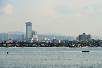
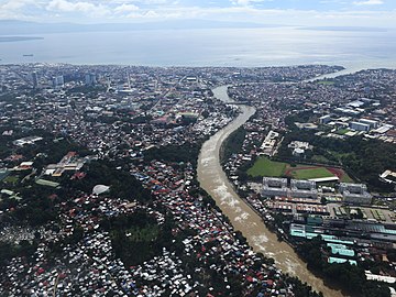
Metro Cebu
3,165,799
1,053.19
406.64
3,000
7,800
Metro Cebu Development and Coordinating Board[7]
10°06′12″N 123°38′26″E / 10.1033°N 123.6405°E / 10.1033; 123.6405 (Carcar ) Carcar
136,453
116.78
45.09
1,200
3,100
10°18′32″N 123°53′35″E / 10.3090°N 123.8930°E / 10.3090; 123.8930 (Cebu City ) Cebu City
964,169
315.00
121.62
3,100
8,000
10°27′26″N 124°00′37″E / 10.4571°N 124.0104°E / 10.4571; 124.0104 (Compostela ) Compostela
55,874
53.90
20.81
1,000
2,600
10°22′35″N 123°57′26″E / 10.3765°N 123.9572°E / 10.3765; 123.9572 (Consolacion ) Consolacion
148,012
37.03
14.30
4,000
10,000
10°15′05″N 123°57′00″E / 10.2515°N 123.9499°E / 10.2515; 123.9499 (Cordova ) Cordova
70,595
17.15
6.62
4,100
11,000
10°31′14″N 124°01′37″E / 10.5205°N 124.0270°E / 10.5205; 124.0270 (Danao ) Danao
156,321
107.30
41.43
1,500
3,900
10°18′39″N 123°56′58″E / 10.3109°N 123.9494°E / 10.3109; 123.9494 (Lapu-Lapu ) Lapu-Lapu (Opon ) 497,604
58.10
22.43
8,600
22,000
10°24′01″N 123°59′57″E / 10.4002°N 123.9993°E / 10.4002; 123.9993 (Liloan ) Liloan
153,197
45.92
17.73
3,300
8,500
10°19′28″N 123°56′34″E / 10.3245°N 123.9428°E / 10.3245; 123.9428 (Mandaue ) Mandaue
364,116
25.18
9.72
14,000
36,000
10°14′42″N 123°47′47″E / 10.2450°N 123.7964°E / 10.2450; 123.7964 (Minglanilla ) Minglanilla
151,002
65.60
25.33
2,300
6,000
10°12′33″N 123°45′24″E / 10.2093°N 123.7567°E / 10.2093; 123.7567 (Naga ) Naga
133,184
101.97
39.37
1,300
3,400
10°09′51″N 123°42′21″E / 10.1643°N 123.7058°E / 10.1643; 123.7058 (San Fernando ) San Fernando 72,224
69.39
26.79
1,000
2,600
10°14′41″N 123°50′50″E / 10.2446°N 123.8473°E / 10.2446; 123.8473 (Talisay ) Talisay
263,048
39.87
15.39
6,600
17,000
Metro Davao
3,339,284
6,492.84
2,506.90
510
1,300
Metropolitan Davao Development Authority[8]
7°21′20″N 125°42′16″E / 7.3556°N 125.7045°E / 7.3556; 125.7045 (Carmen ) Carmen
82,018
166.00
64.09
490
1,300
7°03′50″N 125°36′30″E / 7.0639°N 125.6083°E / 7.0639; 125.6083 (Davao City ) Davao City 1,776,949
2,443.61
943.48
730
1,900
6°44′39″N 125°21′23″E / 6.7443°N 125.3565°E / 6.7443; 125.3565 (Digos ) Digos
188,376
287.10
110.85
660
1,700
6°44′39″N 125°21′23″E / 6.7443°N 125.3565°E / 6.7443; 125.3565 (Hagonoy ) Hagonoy
56,919
114.28
44.12
500
1,300
6°44′39″N 125°21′23″E / 6.7443°N 125.3565°E / 6.7443; 125.3565 (Maco ) Maco
83,237
342.23
132.14
240
620
6°44′39″N 125°21′23″E / 6.7443°N 125.3565°E / 6.7443; 125.3565 (Malalag ) Malalag
40,158
186.12
71.86
220
570
6°44′39″N 125°21′23″E / 6.7443°N 125.3565°E / 6.7443; 125.3565 (Malita ) Malita
118,197
883.37
341.07
130
340
6°56′N 126°58′E / 6.94°N 126.97°E / 6.94; 126.97 (Mati ) Mati
147,547
588.63
227.27
250
650
6°56′N 126°58′E / 6.94°N 126.97°E / 6.94; 126.97 (Padada ) Padada
29,878
83.00
32.05
360
930
7°18′01″N 125°40′57″E / 7.3004°N 125.6826°E / 7.3004; 125.6826 (Panabo ) Panabo
209,230
251.23
97.00
830
2,100
7°04′28″N 125°42′31″E / 7.0744°N 125.7086°E / 7.0744; 125.7086 (Samal ) Samal
116,771
301.30
116.33
390
1,000
6°50′02″N 125°24′55″E / 6.8340°N 125.4154°E / 6.8340; 125.4154 (Santa Cruz ) Santa Cruz 101,125
319.91
123.52
320
830
6°50′02″N 125°24′55″E / 6.8340°N 125.4154°E / 6.8340; 125.4154 (Santa Maria ) Santa Maria 57,526
175.00
67.57
330
850
6°50′02″N 125°24′55″E / 6.8340°N 125.4154°E / 6.8340; 125.4154 (Santa Maria ) Sulop 35,151
155.26
59.95
230
600
7°26′48″N 125°48′34″E / 7.4468°N 125.8095°E / 7.4468; 125.8095 (Tagum ) Tagum
296,202
195.80
75.60
1,500
3,900
Metro Manila
13,484,462
633.11
244.45
21,000
54,000
Metropolitan Manila Development Authority
14°39′26″N 120°59′03″E / 14.6571°N 120.9841°E / 14.6571; 120.9841 (Caloocan ) Caloocan
1,661,584
53.20
20.54
31,000
80,000
14°28′50″N 120°58′55″E / 14.4806°N 120.9819°E / 14.4806; 120.9819 (Las Piñas ) Las Piñas 606,293
32.02
12.36
19,000
49,000
14°33′24″N 121°01′25″E / 14.5568°N 121.0235°E / 14.5568; 121.0235 (Makati ) Makati
629,616
27.36
10.56
23,000
60,000
14°40′31″N 120°57′26″E / 14.6752°N 120.9573°E / 14.6752; 120.9573 (Malabon ) Malabon
380,522
15.96
6.16
24,000
62,000
14°34′39″N 121°02′00″E / 14.5774°N 121.0334°E / 14.5774; 121.0334 (Mandaluyong ) Mandaluyong
425,758
11.06
4.27
38,000
98,000
14°35′26″N 120°58′48″E / 14.5906°N 120.9799°E / 14.5906; 120.9799 (Manila ) Manila
1,846,513
42.88
16.56
43,000
110,000
14°37′59″N 121°05′57″E / 14.6331°N 121.0993°E / 14.6331; 121.0993 (Marikina ) Marikina
456,059
22.64
8.74
20,000
52,000
15°42′47″N 120°54′15″E / 15.7131°N 120.9041°E / 15.7131; 120.9041 (Muntinlupa ) Muntinlupa
543,445
41.67
16.09
13,000
34,000
14°39′25″N 120°56′52″E / 14.6569°N 120.9478°E / 14.6569; 120.9478 (Navotas ) Navotas
247,543
11.51
4.44
22,000
57,000
14°30′03″N 120°59′29″E / 14.5007°N 120.9915°E / 14.5007; 120.9915 (Parañaque ) Parañaque
689,992
47.28
18.25
15,000
39,000
14°32′37″N 120°59′43″E / 14.5437°N 120.9954°E / 14.5437; 120.9954 (Pasay ) Pasay
440,656
18.64
7.20
24,000
62,000
14°33′38″N 121°04′36″E / 14.5605°N 121.0767°E / 14.5605; 121.0767 (Pasig ) Pasig
803,159
31.46
12.15
26,000
67,000
14°32′32″N 121°03′55″E / 14.5421°N 121.0654°E / 14.5421; 121.0654 (Pateros ) Pateros
65,227
1.76
0.68
37,000
96,000
14°39′03″N 121°02′55″E / 14.6509°N 121.0486°E / 14.6509; 121.0486 (Quezon City ) Quezon City 2,960,048
165.33
63.83
18,000
47,000
14°36′17″N 121°01′48″E / 14.6047°N 121.0299°E / 14.6047; 121.0299 (San Juan ) San Juan 126,347
5.87
2.27
22,000
57,000
14°31′36″N 121°04′28″E / 14.5266°N 121.0744°E / 14.5266; 121.0744 (Taguig ) Taguig
886,722
45.18
17.44
20,000
52,000
14°42′28″N 120°56′46″E / 14.7077°N 120.9462°E / 14.7077; 120.9462 (Valenzuela ) Valenzuela
714,978
45.75
17.66
16,000
41,000
Gallery See also References
^ a b "Chapter 3: Overlay of Economic Growth, Demographic Trends, and Physical Characteristics" (PDF) . Philippine Development Plan 2017-2022 . National Economic and Development Authority : 37–38. 2017. Archived from the original (PDF) on July 25, 2020. Retrieved August 1, 2020 .^ "Demographia World Urban Areas, 12th Annual Edition: 2016:04" (PDF) . 2016. Archived from the original (PDF) on February 21, 2017. Retrieved March 24, 2017 . Higher than other estimates, which are largely limited to the National Capital Region. Continuous urbanization extends into Cavite, Laguna, Bulucan [sic ^ "Building Globally Competitive Metro Areas in the Philippines" (PDF) . National Economic and Development Authority the original (PDF) on October 4, 2013. Retrieved February 6, 2014 .^ Census of Population (2020). Table B - Population and Annual Growth Rates by Province, City, and Municipality - By Region PSA . Retrieved July 8, 2021 . ^ "Philippine Standard Geographic Code" . PSGC Interactive . Quezon City, Philippines: Philippine Statistics Authority . Archived from the original on July 6, 2016. Retrieved September 9, 2016 .^ "Philippine Standard Geographic Code" . PSGC Interactive . Quezon City, Philippines: Philippine Statistics Authority . Archived from the original on July 6, 2016. Retrieved September 9, 2016 .^ "What is MCDCB?" . Mega Cebu Blog . March 2, 2014. Retrieved January 11, 2017 .^ Joviland Rita. "Duterte OKs creation of Metropolitan Davao Development Authority" . GMA News Online . Retrieved April 27, 2022 .
External links


(2017-11-19).jpg)

_edit.jpg)