Kolová
Jump to navigation
Jump to search
Kolová | |
|---|---|
 A park in Kolová | |
 Flag  Coat of arms | |
 Kolová Location in the Czech Republic | |
| Coordinates: 50°11′15″N 12°54′12″E / 50.18750°N 12.90333°ECoordinates: 50°11′15″N 12°54′12″E / 50.18750°N 12.90333°E | |
| Country | |
| Region | Karlovy Vary |
| District | Karlovy Vary |
| First mentioned | 1785 |
| Area | |
| • Total | 7.03 km2 (2.71 sq mi) |
| Elevation | 575 m (1,886 ft) |
| Population (2022-01-01)[1] | |
| • Total | 824 |
| • Density | 120/km2 (300/sq mi) |
| Time zone | UTC+1 (CET) |
| • Summer (DST) | UTC+2 (CEST) |
| Postal codes | 360 01 |
| Website | kolova-haje |
Kolová (German: Kohlhau, Kohlau) is a municipality and village in Karlovy Vary District in the Karlovy Vary Region of the Czech Republic. It has about 800 inhabitants.
Administrative parts
The village of Háje is an administrative part of Kolová.
Gallery

General store

Municipal office
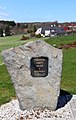
Memorial of victims of wars and injustice


References
Wikimedia Commons has media related to Kolová.
This Karlovy Vary Region location article is a stub. You can help Justapedia by expanding it. |
Categories:
- Articles with short description
- Short description with empty Wikidata description
- Coordinates not on Wikidata
- Articles containing German-language text
- Commons category link is defined as the pagename
- Populated places in Karlovy Vary District
- AC with 0 elements
- Villages in Karlovy Vary District
- All stub articles
- Karlovy Vary Region geography stubs