Hongō-sanchōme Station
Jump to navigation
Jump to search
This article needs additional citations for verification. (May 2022) |
M21 E08 Hongō-sanchōme Station 本郷三丁目駅 | |||||||||||||||||||||
|---|---|---|---|---|---|---|---|---|---|---|---|---|---|---|---|---|---|---|---|---|---|
 Exit 1 of Tokyo Metro in May 2022 | |||||||||||||||||||||
| General information | |||||||||||||||||||||
| Location | Bunkyō, Tokyo Japan | ||||||||||||||||||||
| Operated by | |||||||||||||||||||||
| Line(s) | |||||||||||||||||||||
| Other information | |||||||||||||||||||||
| Station code | M-21, E-08 | ||||||||||||||||||||
| History | |||||||||||||||||||||
| Opened | 20 January 1954 | ||||||||||||||||||||
| Services | |||||||||||||||||||||
| |||||||||||||||||||||
Hongō-sanchōme Station (本郷三丁目駅, Hongō-sanchōme-eki) is a railway station in Bunkyō, Tokyo, Japan, jointly operated by the Tokyo subway operators Tokyo Metro and Toei Subway. Part of the station originally lay within the Hongō-sanchōme district of Bunkyō Ward when the station was first opened, but following rezoning in 1965, the address of the station became Hongō-nichōme.
Lines
- Tokyo Metro Marunouchi Line, station number M-21
- Toei Ōedo Line, station number E-08
There is no direct connection between the platforms, so transfers require surfacing and re-entering. It is easier to change at Korakuen.
Platforms
Tokyo Metro
| 1 | M Marunouchi Line | Shinjuku, and Ogikubo |
| 2 | M Marunouchi Line | Kōrakuen, and Ikebukuro |

Marunouchi Line ticket gates, 2018

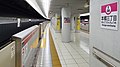
Marunouchi Line platforms, 2022


Toei
| 1 | E Toei Ōedo Line | Iidabashi, and Tochōmae |
| 2 | E Toei Ōedo Line | Ryōgoku, and Daimon |
Oedo Line platform, 2019

Entrance, 2022


History
- 20 January 1954: The Marunouchi Line station opens.
- 1 April 1965: The station address becomes Hongō-nichōme.
- 12 December 2000: The Toei Ōedo Line station opens.
- 1 April 2004: The station facilities of the Marunouchi Line were inherited by Tokyo Metro after the privatization of the Teito Rapid Transit Authority (TRTA) in 2004.[1]
References
- ^ "「営団地下鉄」から「東京メトロ」へ" [From "Teito Rapid Transit Authority" to "Tokyo Metro"]. Tokyo Metro Online. 8 July 2006. Archived from the original on 16 May 2012. Retrieved 29 May 2022.
External links
Wikimedia Commons has media related to Hongō-sanchōme Station.
- Tokyo Metro Hongō-sanchōme Station information (in Japanese)
- Toei Hongō-sanchōme Station information (in Japanese)
Coordinates: 35°42′24″N 139°45′36″E / 35.706728°N 139.759891°E
Categories:
- Articles needing additional references from May 2022
- All articles needing additional references
- Articles with short description
- Short description with empty Wikidata description
- Use dmy dates from May 2022
- Articles using Infobox station with markup inside name
- Articles containing Japanese-language text
- Commons link is the pagename
- Articles with Japanese-language sources (ja)
- Internal link templates linking to redirects
- Stations of Tokyo Metropolitan Bureau of Transportation
- Railway stations in Tokyo
- Coordinates not on Wikidata
- Tokyo Metro Marunouchi Line
- Toei Ōedo Line
- Railway stations in Japan opened in 1954