Gauli Glacier
Jump to navigation
Jump to search
| Gauli Glacier | |
|---|---|
| Gauligletscher | |
 Gauligletscher (far right) | |
| Coordinates | 46°36′41″N 8°11′11″E / 46.61139°N 8.18639°ECoordinates: 46°36′41″N 8°11′11″E / 46.61139°N 8.18639°E |
| Length | 6.2 km |
| Lua error in Module:Mapframe at line 384: attempt to perform arithmetic on local 'lat_d' (a nil value). | |
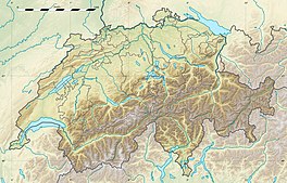
The Gauli Glacier (German: Gauligletscher) is a 6.2 km (3.9 mi) long glacier (2005) in the Bernese Alps in the canton of Bern in Switzerland. In 1973, it had an area of 17.7 km2 (6.8 sq mi). The glacier is famous for the 1946 C-53 Skytrooper crash on the Gauli Glacier and the following rescue mission, which was the first carried out by an aircraft (Fieseler Storch) landing on a glacier.
A lake is located at the bottom of the glacier, at a height of 2,146 metres above sea level.[1] Its surface area is 0.28 km²[2]
See also
References
- ^ Height retrieved from the Swisstopo topographic maps
- ^ Area retrieved from Google Earth (July 2013)
External links
Categories:
- Pages with script errors
- Articles with short description
- Short description with empty Wikidata description
- Coordinates not on Wikidata
- Articles containing German-language text
- Glaciers of the canton of Bern
- Glaciers of the Alps
- Aare basin
- All stub articles
- Switzerland glacier stubs
- Canton of Bern geography stubs


