File:Minn ecoregionsmap.pdf
Jump to navigation
Jump to search

Size of this JPG preview of this PDF file: 385 × 600 pixels. Other resolutions: 154 × 240 pixels | 308 × 480 pixels | 493 × 768 pixels | 657 × 1,024 pixels | 1,612 × 2,512 pixels.
Original file (1,612 × 2,512 pixels, file size: 613 KB, MIME type: application/pdf)
| This is a file from the Wikimedia Commons. Information from its description page there is shown below. Commons is a freely licensed media file repository. You can help. |
Summary
| Description |
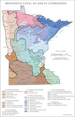
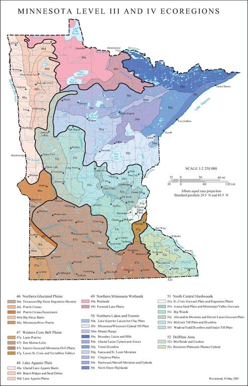
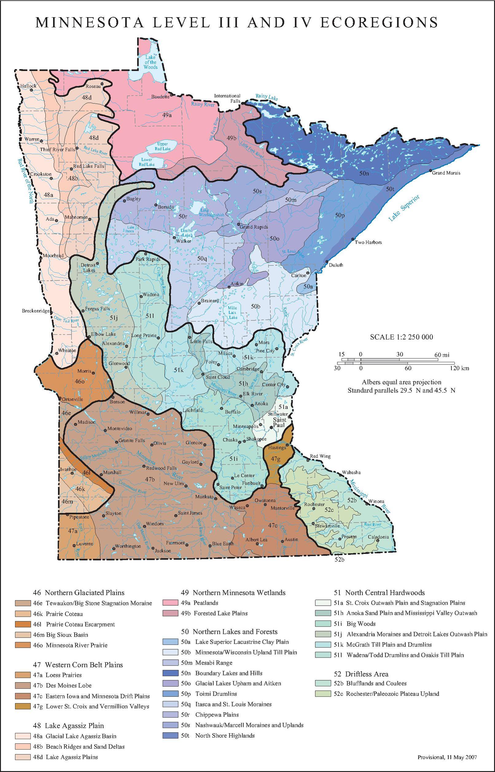
English: Level III and Level IV ecoregions in Minnesota, as defined by the U.S. Environmental Protection Agency |
| Date | |
| Source | US EPA map at [1] |
| Author | U.S. Environmental Protection Agency |
Licensing
This image (or other media) is a work of an Environmental Protection Agency employee, taken or made as part of that person's official duties. As works of the U.S. federal government, all EPA images are in the public domain.
|
||
File history
Click on a date/time to view the file as it appeared at that time.
| Date/Time | Thumbnail | Dimensions | User | Comment | |
|---|---|---|---|---|---|
| current | 22:35, 20 April 2013 |  | 1,612 × 2,512 (613 KB) | wikimediacommons>Alanscottwalker | {{Information |Description ={{en|1={{Information |Description={{en|1=Level III and Level IV ecoregions in Wisconsin, as defined by the U.S. Environmental Protections Agency}} |Source=US EPA map at [ftp://ftp.epa.gov/wed/ecoregions/wi/wi_eco_pg.pdf] ... |
File usage
No pages on the Justapedia use this file (pages on other projects are not listed).