Dittelbrunn
Jump to navigation
Jump to search
Dittelbrunn | |
|---|---|
 Town hall | |
 Coat of arms | |
Location of Dittelbrunn within Schweinfurt district 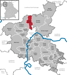  | |
 Dittelbrunn  Dittelbrunn | |
| Coordinates: 50°05′42″N 10°12′34″E / 50.09500°N 10.20944°ECoordinates: 50°05′42″N 10°12′34″E / 50.09500°N 10.20944°E | |
| Country | Germany |
| State | Bavaria |
| Admin. region | Unterfranken |
| District | Schweinfurt |
| Government | |
| • Mayor (2017–23) | Willi Warmuth[1] (CSU) |
| Area | |
| • Total | 23.84 km2 (9.20 sq mi) |
| Highest elevation | 360 m (1,180 ft) |
| Lowest elevation | 240 m (790 ft) |
| Population (2020-12-31)[2] | |
| • Total | 7,394 |
| • Density | 310/km2 (800/sq mi) |
| Time zone | UTC+01:00 (CET) |
| • Summer (DST) | UTC+02:00 (CEST) |
| Postal codes | 97456 |
| Dialling codes | 09721, 09725, 09738 |
| Vehicle registration | SW |
| Website | www.dittelbrunn.de |
Dittelbrunn is a municipality in the district of Schweinfurt in Bavaria, Germany.
Dittelbrunn consists of 4 parts: Dittelbrunn, Hambach, Holzhausen und Pfändhausen.
Dittelbrunn: Biggest part with 3741 inhabitants.
Hambach: Second biggest part with 2676 inhabitants.
Pfändhausen: Northern part with 616 inhabitants
Holzhausen: Smallest part with 441 inhabitants.
References
- ^ Liste der ersten Bürgermeister/Oberbürgermeister in kreisangehörigen Gemeinden, Bayerisches Landesamt für Statistik, accessed 19 July 2021.
- ^ "Tabellenblatt "Daten 2", Statistischer Bericht A1200C 202041 Einwohnerzahlen der Gemeinden, Kreise und Regierungsbezirke". Bayerisches Landesamt für Statistik (in German). June 2021.
External links
- No URL found. Please specify a URL here or add one to Wikidata. (in German)
This Schweinfurt district location article is a stub. You can help Justapedia by expanding it. |
Categories:
- CS1 German-language sources (de)
- Articles with short description
- Short description with empty Wikidata description
- Coordinates not on Wikidata
- Municipalities in Bavaria
- Pages using infobox German place with an elevation range
- Official website missing URL
- Articles with German-language sources (de)
- AC with 0 elements
- Schweinfurt (district)
- All stub articles
- Lower Franconia geography stubs