Damavand, Iran
Damavand
Damāwand | |
|---|---|
City | |
 The 15th century Jame mosque of Damavand. | |
 Damavand | |
| Coordinates: 35°43′04″N 52°03′54″E / 35.71778°N 52.06500°ECoordinates: 35°43′04″N 52°03′54″E / 35.71778°N 52.06500°E | |
| Country | Iran |
| Province | Tehran |
| County | Damavand |
| Bakhsh | Central |
| Population (2016 Census) | |
| • Total | 48,380[1] |
| Time zone | UTC+3:30 (IRST) |
| • Summer (DST) | UTC+4:30 (IRDT) |
| Website | Official website |
Damavand (Persian: Damāwand, also romanized as Damāvand and Demāvend; also known as Qasabehe Damāwand)[2] is a city and capital of Damavand County, Tehran Province, Iran.
Damavand is an ancient and historic city. The name Damavand appears in Sassanid texts (as Dunbawand), and Parthian remains have been found there. The city fell to Arab Muslim invaders in 651 CE. It is close to Iran's tallest peak Mount Damavand, which Ferdowsi mentions abundantly in the Shahnameh. The city has relatively cool weather year-round.
Climate
Damavand has a cold semi-arid climate and is classified as BSk by the Köppen-Geiger System. The average annual temperature is 9.6°C in Damavand.
| Climate data for Damavand | |||||||||||||
|---|---|---|---|---|---|---|---|---|---|---|---|---|---|
| Month | Jan | Feb | Mar | Apr | May | Jun | Jul | Aug | Sep | Oct | Nov | Dec | Year |
| Average high °C (°F) | −1.1 (30.0) |
0.4 (32.7) |
6 (43) |
12.4 (54.3) |
19.1 (66.4) |
25.1 (77.2) |
27.6 (81.7) |
26.5 (79.7) |
22.3 (72.1) |
15.5 (59.9) |
6.2 (43.2) |
1.2 (34.2) |
13.4 (56.2) |
| Daily mean °C (°F) | −4.3 (24.3) |
−2.8 (27.0) |
2.5 (36.5) |
8.5 (47.3) |
14.9 (58.8) |
20.5 (68.9) |
23 (73) |
22 (72) |
18.2 (64.8) |
11.8 (53.2) |
2.8 (37.0) |
−2 (28) |
9.6 (49.2) |
| Average low °C (°F) | −7.9 (17.8) |
−6.5 (20.3) |
−1.7 (28.9) |
3.8 (38.8) |
9.7 (49.5) |
14.5 (58.1) |
17.3 (63.1) |
16.6 (61.9) |
13.6 (56.5) |
8.1 (46.6) |
−0.8 (30.6) |
−5.5 (22.1) |
5.1 (41.2) |
| Average precipitation mm (inches) | 39 (1.5) |
46 (1.8) |
62 (2.4) |
53 (2.1) |
32 (1.3) |
12 (0.5) |
11 (0.4) |
8 (0.3) |
8 (0.3) |
26 (1.0) |
39 (1.5) |
38 (1.5) |
374 (14.6) |
| Average precipitation days (≥ 1.0 mm) | 6 | 7 | 7 | 7 | 5 | 2 | 2 | 1 | 2 | 4 | 6 | 5 | 54 |
| Average relative humidity (%) | 59 | 61 | 56 | 49 | 35 | 27 | 30 | 30 | 30 | 41 | 60 | 60 | 45 |
| Source: https://en.climate-data.org/asia/iran/tehran/damavand-768465/ | |||||||||||||
Economic situation
Damavand is an agricultural city and due to its streams, rivers, springs and temperate climate, it has numerous gardens and fields. An important part of the city's economy is provided by the export of tree products. Apples, pears, cherries, apricots, walnuts, apricots, tomatoes, wheat, potatoes, beans and cucumbers are some of the products of this city, some of which, like apples and pears, are famous and distinguished in terms of type. In recent years, beekeeping has become one of the sources of income for the people of this city and Damavand honey competes with the best honey in Iran in terms of quality and constitutes a significant part of the city's exports. New style livestock has been developed in Damavand for several years and the obtained products are exported to Tehran in addition to meeting the needs of the region.
Main sights
Damavand contains 37 historical tombs (Imamzadeh), 27 castle ruins, 23 traditional houses of architectural significance, 18 traditional bath houses, 6 caves, 5 historical bridges, 3 historical mosques, and 3 caravanserais.
The main landmarks are the Friday Mosque (15th century) and the Sheikh Shebli Mausoleum and Tower, dating to the Seljuq era.
Transportation
Damavand can be reached by road from Firuzkuh via Gilavand and from Haraz road, via Mosha.

View of Damavand and the Alborz Mountains
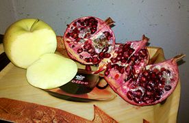
Damavand's pomegranate and apple


.jpg)
See also
References
- ^ "Population and Housing Censuses". Statistical Center of Iran. Retrieved 30 August 2021.
- ^ Damavand, Iran can be found at GEOnet Names Server, at this link, by opening the Advanced Search box, entering "-3059147" in the "Unique Feature Id" form, and clicking on "Search Database".
External links

| Capital | |||||||||||||||||||||||
|---|---|---|---|---|---|---|---|---|---|---|---|---|---|---|---|---|---|---|---|---|---|---|---|
| Districts |
| ||||||||||||||||||||||