Cherwell District
Cherwell
Cherwell District | |
|---|---|
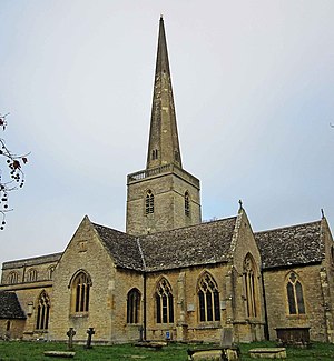
 Banbury, is the largest settlement in the district | |
 Cherwell shown within Oxfordshire | |
| Coordinates: 51°57′N 1°15′W / 51.95°N 1.25°WCoordinates: 51°57′N 1°15′W / 51.95°N 1.25°W | |
| Sovereign state | United Kingdom |
| Constituent country | England |
| Region | South East England |
| Non-metropolitan county | Oxfordshire |
| Status | Non-metropolitan district |
| Admin HQ | Bodicote |
| Incorporated | 1 April 1974 |
| Government | |
| • Type | Non-metropolitan district council |
| • Body | Cherwell District Council |
| • Leadership | Leader & Cabinet (Conservative) |
| • MPs | |
| Area | |
| • Total | 227.3 sq mi (588.8 km2) |
| • Rank | 73rd (of 309) |
| Population (mid-2019 est.) | |
| • Total | 150,503 |
| • Rank | 136th (of 309) |
| • Density | 660/sq mi (260/km2) |
| • Ethnicity | 94.5% White 2.3% S.Asian 1.0% Black 1.4% Mixed Race |
| Time zone | UTC0 (GMT) |
| • Summer (DST) | UTC+1 (BST) |
| ONS code | 38UB (ONS) E07000177 (GSS) |
| OS grid reference | SP5153928258 |
| Website | www |

Cherwell (/ˈtʃɜːrwɛl/ CHER-wel)[1][2] is a local government district in northern Oxfordshire, England. The district takes its name from the River Cherwell, which drains south through the region to flow into the River Thames at Oxford.

Towns in Cherwell include Banbury and Bicester. Kidlington is a contender for largest village in England.
The district was formed on 1 April 1974, under the Local Government Act 1972, by a merger of the municipal borough of Banbury, Bicester urban district, Banbury Rural District and Ploughley Rural District.
Geography
The Northern half of the Cherwell district consists mainly of soft rolling hills going down towards the River Cherwell, but the southern half of the district around Bicester is much flatter. Much of the district is soft rolling hills with the northwest of the district lying at the northern extremity of the Cotswolds.
Transport
Much of the district is within easy reach of the M40, with junctions 9, 10 and 11 in the district. It also has good rail links with London, Birmingham, Oxford and the South.
Politics
Elections to the council are held in three out of every four years, with one third of the 48 seats on the council being elected at each election. Since the 2000 election the Conservative party has had a majority on the council. This followed 2 years of no overall control, in turn preceded by 2 years of control by Labour.
Following the 2021 election, the make-up of the council is as follows:
| Party | Councillors | |
| Conservative Party | 31 | |
| Labour Party | 9 | |
| Independent | 4 | |
| Liberal Democrats | 3 | |
| Green Party | 1 | |
Settlements in Cherwell district
- Adderbury, Ambrosden, Ardley, Arncott
- Banbury, Barford St. John, Barford St. Michael, Begbroke, Bicester
- Blackthorn
- Bletchingdon, Bloxham, Bodicote
- Broughton
- Bucknell, Burdrop
- Charlton-on-Otmoor, Claydon, Cottisford, Cropredy
- Deddington, Drayton, Duns Tew
- Epwell
- Fencott, Finmere, Fringford, Fritwell
- Godington, Gosford, Great Bourton
- Hampton Poyle, Hanwell, Hardwick, Hethe
- Hook Norton, Horley
- Islip
- Juniper Hill
- Kidlington, Kirtlington
- Launton, Little Bourton, Lower Heyford
- Merton, Middle Aston, Middleton Stoney
- Milcombe, Milton, Mixbury, Mollington, Murcott
- Noke, North Aston, North Newington
- Oddington
- Prescote
- Shenington, Shipton-on-Cherwell, Shutford
- Sibford Ferris, Sibford Gower, Somerton
- Souldern, South Newington, Steeple Aston, Stoke Lyne, Swalcliffe
- Tadmarton, Thrupp
- Upper Heyford
- Wardington, Water Eaton, Weston-on-the-Green, Wroxton
- Yarnton
Recycling in Cherwell
Cherwell district has one of the country's highest recycling rates at over 40% (2005). The district used to have a recycling rate of just 9%. This changed with the introduction of the blue box scheme for recycling paper, which has since grown to include plastic, cardboard and cans. Kidlington has its own freecycling group.
Food safety enforcement
Cherwell District came top of a Which? study that ranked 395 local authorities in Britain on their record of enforcement of food safety regulations.[3]
Leisure Provision
Cherwell District provides a range of leisure and sporting facilities to local residents, catering to a range of sports through their leisure centres and open spaces.[4]
Arms
|
See also
References
- ^ "How do you pronounce Cherwell?". www.bbc.co.uk.
- ^ Ann Spokes Symonds; Nigel Morgan (2010). The Origins of Oxford Street Names. p. 36. ISBN 978-1-899536-99-3.
- ^ "How does your council score on enforcing food safety?". www.telegraph.co.uk.
- ^ "Sport and Leisure Provision in Cherwell District". Archived from the original on 21 September 2021.
- ^ "Civic Heraldry of England". Robert Young. Retrieved 12 March 2019.

