Caicara del Orinoco Airport
Jump to navigation
Jump to search
Caicara de Orinoco Airport Aeropuerto de Caicara del Orinoco | |||||||||||
|---|---|---|---|---|---|---|---|---|---|---|---|
| Summary | |||||||||||
| Airport type | Public | ||||||||||
| Serves | Caicara del Orinoco | ||||||||||
| Elevation AMSL | 140 ft / 43 m | ||||||||||
| Coordinates | 7°37′33″N 66°09′55″W / 7.62583°N 66.16528°WCoordinates: 7°37′33″N 66°09′55″W / 7.62583°N 66.16528°W | ||||||||||
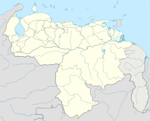
| Map | |||||||||||
| Runways | |||||||||||
| |||||||||||
Sources: GCM[1] | |||||||||||
Caicara del Orinoco Airport (IATA: CXA, ICAO: SVCD) is an airport serving the city of Caicara del Orinoco in the Bolívar state of Venezuela. Western approaches and departures cross the Orinoco River.
See also
References
- ^ Airport information for CXA at Great Circle Mapper.
External links
