Călimani National Park
Jump to navigation
Jump to search
| Călimani National Park | |
|---|---|
| Parcul Național Călimani | |
 Călimani Mountains | |
| Location | In the administrative territory of counties: |
| Nearest city | Vatra Dornei |
| Coordinates | 47°07′37″N 25°10′05″E / 47.127°N 25.168°E[1]Coordinates: 47°07′37″N 25°10′05″E / 47.127°N 25.168°E[1] |
| Area | 24.041 hectares (59.41 acres) |
| Established | 2000 |
| Website | www.calimani.ro |
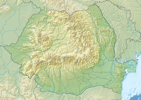
The Călimani National Park (Romanian: Parcul Naţional Călimani) is a protected area (national park category II IUCN) situated in Romania and located at Northern side of Eastern Carpathians (Bistrita – Nasaud, Harghita, Mures and Suceava counties). In the administrativ territory of counties Mureș (45%), Suceava (35%), Harghita (15%), and Bistrița-Năsăud. It has 64,000 acres.[2] It protects the Călimani Mountains.
See also
References
- ^ eunis.eea.europa.eu – Călimani National Park (coords.); retrieved on June 23, 2012
- ^ protectedplanet.net – Călimani National Park (location); retrieved on June 23, 2012
Wikimedia Commons has media related to Călimani National Park.
Categories:
- IUCN Category II
- Coordinates not on Wikidata
- Articles containing Romanian-language text
- Commons category link is defined as the pagename
- AC with 0 elements
- National parks of Romania
- Protected areas established in 2000
- Geography of Mureș County
- Geography of Suceava County
- Geography of Harghita County
- Geography of Bistrița-Năsăud County
- Tourist attractions in Mureș County
- Tourist attractions in Suceava County
- Tourist attractions in Harghita County
- Tourist attractions in Bistrița-Năsăud County
- All stub articles
- Romania geography stubs
- European protected area stubs

