Balmazújváros
Jump to navigation
Jump to search
Balmazújváros | |
|---|---|
 Aerial view | |
| Coordinates: 47°37′N 21°21′E / 47.617°N 21.350°E | |
| Country | |
| County | Hajdú-Bihar |
| District | Balmazújváros |
| Area | |
| • Total | 205.45 km2 (79.32 sq mi) |
| Population (2001) | |
| • Total | 18,149 |
| • Density | 88.34/km2 (228.8/sq mi) |
| Time zone | UTC+1 (CET) |
| • Summer (DST) | UTC+2 (CEST) |
| Postal code | 4060 |
| Area code | (+36) 52 |
| Website | www |
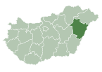
Balmazújváros [ˈbɒlmɒzuːjvaːroʃ] is a town in Hajdú-Bihar county, in the Northern Great Plain region of eastern Hungary.
Geography
It covers an area of 205.45 km2 (79 sq mi) and has a population of 18,149 people (2001).
Twin towns – sister cities
Balmazújváros is twinned with:[1]
 Łańcut, Poland (2002)
 Valea lui Mihai (Érmihályfalva), Romania (2008)
 Gulbene, Latvia (2012)
 Tiachiv (Técső), Ukraine (2015)[2]
Government
General Council | |
|---|---|
| General Council | |
 | |
| Type | |
| Type | |
| History | |
| Founded | 1911 |
| Leadership | |
Hegedűs Péter since 2019 | |
| Structure | |
| Seats | 11 Delegate |
 | |
House political groups | Government
Opposition
|
| Meeting place | |
 | |
| Meeting house. | |
Demographics
Ethnics
Hungarians (87%)
Roma (8%)
Germans (3%)
Poles (1%)
Albanians (1%)
Arabs and chinese (1%)
Ethnics in Németfalu (Germanvillage)
Hungarians (45%)
Germano-Hungarians (35%)
Germans (30%)
Ethnics in Bánlak
Hungarians (87%)
Poles (7%)
Roma (6%)
References
- ^ "Testvérvárosok". balmazujvaros.hu (in Hungarian). Balmazújváros. Retrieved 2021-04-07.
- ^ "Міста-побратими". tyachiv-city.gov.ua (in Ukrainian). Tiachiv. Retrieved 2021-04-07.


