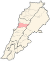
Ballouneh
Jump to navigation
Jump to search
Ballouneh
Balloune | |
|---|---|
Municipality | |
| Coordinates: 33°56′58″N 35°40′29″E / 33.94944°N 35.67472°E | |
| Country | |
| Governorate | Keserwan-Jbeil |
| District | Keserwan |
| Area | |
| • Total | 3.93 km2 (1.52 sq mi) |
| Elevation | 650 m (2,130 ft) |
| Time zone | UTC+2 (EET) |
| • Summer (DST) | UTC+3 (EEST) |
Ballouneh (Arabic: بلونة) is a town and municipality in the Keserwan District of the Keserwan-Jbeil Governorate of Lebanon. It is located 18 kilometers north of Beirut.[1] It has an approximate area of 3.93 square kilometers and an average elevation of 650 meters above sea level.[1] Ballouneh's inhabitants are predominantly Maronite Catholics, although Christians from other denominations also live in the town.[2]
Etymology
This article needs additional citations for verification. (January 2017) |
There are two versions regarding the origin of the word Ballouneh, either deriving from the Syriac word ballani/ballana meaning bath or pertaining to the Greek name of the god Apollo.
Notable sites
- The old Roman well (near the municipality's building)
- The house of Sheikh Abou Nader el Khazen
- The church of St. Mary (dating back to the sixteenth century)
See also
References
- ^ a b "Ballouneh". Localiban. Localiban. 2008-01-19. Retrieved 2009-07-24.
- ^ "Elections municipales et ikhtiariah au Mont-Liban" (PDF). Localiban. Localiban. 2010. p. 19. Archived from the original (pdf) on 2015-07-24. Retrieved 2016-02-12.


