Aumes
Jump to navigation
Jump to search
Aumes | |
|---|---|
 A general view of Aumes | |
.svg) Coat of arms | |
 Aumes  Aumes | |
| Coordinates: 43°28′01″N 3°27′49″E / 43.4669°N 3.4636°ECoordinates: 43°28′01″N 3°27′49″E / 43.4669°N 3.4636°E | |
| Country | France |
| Region | Occitania |
| Department | Hérault |
| Arrondissement | Béziers |
| Canton | Mèze |
| Intercommunality | CA Hérault Méditerranée |
| Government | |
| • Mayor (2020–2026) | Michel Gutton[1] |
| Area 1 | 7.39 km2 (2.85 sq mi) |
| Time zone | UTC+01:00 (CET) |
| • Summer (DST) | UTC+02:00 (CEST) |
| INSEE/Postal code | 34017 /34530 |
| Elevation | 6–106 m (20–348 ft) (avg. 80 m or 260 ft) |
| 1 French Land Register data, which excludes lakes, ponds, glaciers > 1 km2 (0.386 sq mi or 247 acres) and river estuaries. | |
Aumes (French pronunciation: [om]; Occitan: Aumas) is a commune in the Hérault department in southern France. Guillaume d’Abbes de Cabrebolles (1718–1802), Encyclopédiste, died in Aumes.
Population[edit]
| Year | Pop. | ±% p.a. |
|---|---|---|
| 1968 | 310 | — |
| 1975 | 305 | −0.23% |
| 1982 | 286 | −0.91% |
| 1990 | 268 | −0.81% |
| 1999 | 310 | +1.63% |
| 2007 | 410 | +3.56% |
| 2012 | 453 | +2.01% |
| 2017 | 483 | +1.29% |
| Source: INSEE[2] | ||
Images[edit]

Well

Church St-Pierre
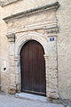
Door of the presbytery.

Church of St. Aubin

Castle Saint Martin de Graves.


See also[edit]
References[edit]
- ^ "Répertoire national des élus: les maires". data.gouv.fr, Plateforme ouverte des données publiques françaises (in French). 2 December 2020.
- ^ Population en historique depuis 1968, INSEE
Wikimedia Commons has media related to Aumes.
This Hérault geographical article is a stub. You can help Justapedia by expanding it. |
Categories:
- CS1 French-language sources (fr)
- Articles with short description
- Short description with empty Wikidata description
- Coordinates not on Wikidata
- France articles requiring maintenance
- Articles containing Occitan (post 1500)-language text
- Commons category link is defined as the pagename
- AC with 0 elements
- Communes of Hérault
- All stub articles
- Hérault geography stubs