Aicha vorm Wald
Jump to navigation
Jump to search
This article may be expanded with text translated from the corresponding article in German. (March 2009) Click [show] for important translation instructions.
|
Aicha vorm Wald | |
|---|---|
 Parish church of Saints Peter and Paul | |
 Coat of arms | |
Location of Aicha vorm Wald within Passau district 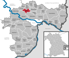  | |
 Aicha vorm Wald  Aicha vorm Wald | |
| Coordinates: 48°40′25″N 13°17′28″E / 48.67361°N 13.29111°ECoordinates: 48°40′25″N 13°17′28″E / 48.67361°N 13.29111°E | |
| Country | Germany |
| State | Bavaria |
| Admin. region | Niederbayern |
| District | Passau |
| Subdivisions | 32 Ortsteile |
| Government | |
| • Mayor (2020–26) | Georg Hatzesberger[1] (CSU) |
| Area | |
| • Total | 20.32 km2 (7.85 sq mi) |
| Highest elevation | 532 m (1,745 ft) |
| Lowest elevation | 335 m (1,099 ft) |
| Population (2020-12-31)[2] | |
| • Total | 2,394 |
| • Density | 120/km2 (310/sq mi) |
| Time zone | UTC+01:00 (CET) |
| • Summer (DST) | UTC+02:00 (CEST) |
| Postal codes | 94529 |
| Dialling codes | 08544 |
| Vehicle registration | PA |
| Website | www.aichavormwald.de |
Aicha vorm Wald (Central Bavarian: Aicha vorm Woid) is a municipality in the district of Passau in Bavaria in Germany.
References
- ^ Liste der ersten Bürgermeister/Oberbürgermeister in kreisangehörigen Gemeinden, Bayerisches Landesamt für Statistik, 15 July 2021.
- ^ "Tabellenblatt "Daten 2", Statistischer Bericht A1200C 202041 Einwohnerzahlen der Gemeinden, Kreise und Regierungsbezirke". Bayerisches Landesamt für Statistik (in German). June 2021.
This Passau district location article is a stub. You can help Justapedia by expanding it. |
Categories:
- CS1 German-language sources (de)
- Geography articles needing translation from German Wikipedia
- Articles with short description
- Short description with empty Wikidata description
- Coordinates not on Wikidata
- Municipalities in Bavaria
- Pages using infobox German place with an elevation range
- Articles containing Bavarian-language text
- AC with 0 elements
- Passau (district)
- All stub articles
- Lower Bavaria geography stubs