Agalakuppa
From Justapedia, unleashing the power of collective wisdom
Jump to navigation
Jump to search
Village in Karnataka, India
Agalakuppe | |
|---|---|
village | |
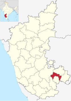
 Agalakuppe is in Bangalore Rural district | |
| Coordinates: 13°13′54″N 77°13′44″E / 13.2317°N 77.2289°E / 13.2317; 77.2289Coordinates: 13°13′54″N 77°13′44″E / 13.2317°N 77.2289°E / 13.2317; 77.2289 | |
| Country | |
| State | Karnataka |
| District | Bangalore Rural |
| Talukas | Nelamangala |
| Government | |
| • Body | Village Panchayat |
| Population (2001) | |
| • Total | 580 |
| Languages | |
| • Official | Kannada |
| Time zone | UTC+5:30 (IST) |
| Nearest city Dabaspete | Bangalore Rural |
| Civic agency | Village Panchayat |
- Agalakuppe is a village near Dabaspete town & Dabaspete Industry Area in the southern state of Karnataka .
- In Agalakuppe village you can see
- 1) Veerabhadra swamy temple with small Kalyani which was built during Cholas period.
- 2) Ranganatha swamy temple
- 3) Kumata Sri Rama temple - Popular temple where many seva will be performed on every Sundays.
- 4) maramma temples
- 5) Sri maha Lakshmi temple.
- In this village one government school, Milk dairy ,public water purifying unit can been seen.
- Agalakuppe village have multiple floor mills and grinding shops as this village is near to chikka siddhara hill ,where they will make Non-veg functions.
- Karnataka , India.[1][2] It is located in Sompura Hobli, Nelamangala taluk of Bangalore Rural district in Karnataka.
See also
References
- ^ "Office of the Registrar General & Census Commissioner, India". Census Village code= 624733. Archived from the original on 25 September 2012.
- ^ "Agalakuppe · Karnataka 562111, India". Agalakuppe · Karnataka 562111, India. Retrieved 25 July 2021.
External links
This article related to a location in Bangalore Rural district, Karnataka, India is a stub. You can help Justapedia by expanding it. |
Retrieved from "https://justapedia.org/index.php?title=Agalakuppa&oldid=1111549079"
Categories:
- Use dmy dates from April 2018
- Use Indian English from April 2018
- All Justapedia articles written in Indian English
- Articles with short description
- Coordinates not on Wikidata
- Pages using infobox settlement with no map
- Villages in Bangalore Rural district
- All stub articles
- Bangalore Rural district geography stubs