1983 Biga earthquake
Jump to navigation
Jump to search
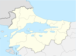
Location of epicenter in the Marmara region | |
| UTC time | 1983-07-05 12:01:30 |
|---|---|
| ISC event | 571502 |
| USGS-ANSS | ComCat |
| Local date | 5 July 1983 |
| Local time | 15:01:30 EEST |
| Magnitude | 6.1 Ms |
| Depth | 10 km |
| Epicenter | 40°19′26″N 27°13′19″E / 40.324°N 27.222°ECoordinates: 40°19′26″N 27°13′19″E / 40.324°N 27.222°E[1] |
| Areas affected | Turkey Biga |
| Max. intensity | IX (Violent) |
| Landslides | Yes |
| Casualties | 5 killed |
The 1983 Biga earthquake hit northwestern Turkey on 5 July 1983. Responsible for five deaths and approximately twenty-six casualties throughout Biga and Erdek and damage in Istanbul, the earthquake measured 6.1 on the surface wave magnitude scale. It shook places as far away as eastern Greece. The United States Geological Survey listed the earthquake among the "Significant Earthquakes of the World" for 1983.[2]
Geology
The Biga Peninsula is an area marked by active faults including strike-slip movement and en echelon divergent basins.
The earthquake was preceded by a foreshock nearly a year prior, and was followed by aftershock clusters.
References
- ^ NGDC. "Comments for the Significant Earthquake". Retrieved 27 August 2010.
- ^ "Significant Earthquakes of the World, 1983". United States Geological Survey. 5 January 2010. Retrieved 5 July 2010.
External links
- The International Seismological Centre has a bibliography and/or authoritative data for this event.
Categories:
- Articles with short description
- Short description with empty Wikidata description
- Use dmy dates from March 2012
- Articles using MS magnitude scale
- Coordinates not on Wikidata
- 1983 earthquakes
- Earthquakes in Turkey
- Geology of Turkey
- 1983 in Turkey
- History of Çanakkale Province
- July 1983 events in Europe
- 1983 disasters in Turkey
