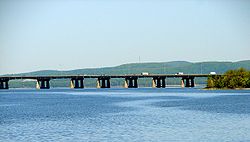
Île aux Tourtes Bridge
Île aux Tourtes Bridge | |
|---|---|
 | |
| Carries | Quebec Autoroute 40/Trans-Canada Highway |
| Crosses | Lake of Two Mountains |
| Locale | Vaudreuil, Quebec |
| Official name | Pont de l'Île aux Tourtes |
| Characteristics | |
| Total length | 2 km (1.2 mi) |
| History | |
| Opened | 1966 |
The Île aux Tourtes Bridge is a bridge on the western tip of the Island of Montreal, spanning Lake of Two Mountains between Senneville, and Vaudreuil-Dorion, Quebec, Canada. It carries 6 lanes of Autoroute 40 and is the main transportation link between Montreal and the province of Ontario. At 2 km in length,[1] it is the longest bridge in Quebec to cross a body of water other than the Saint Lawrence River.[citation needed] It is also commonly known by Montreal's English community as the Lake of Two Mountains bridge.
On May 20, 2021, the government of Quebec announced an indefinite emergency closure of the bridge,[2] after indications that some of the steel reinforcing rods in the bridge support were damaged during routine maintenance work in April.[3] In the interim, the government made travel on the Vaudreuil-Hudson commuter rail line free, and removed tolls from the Quebec Autoroute 30 toll bridge, as alternatives until the Île aux Tourtes Bridge could be safely reopened. The bridge itself was reopened 2 weeks later on June 2, 2021, sooner than the government had anticipated.
See also
References
- ^ Genivar (2004). "Île-aux-Tourtes Bridge Repair, Montreal, Vaudreuil". Retrieved 2007-11-19.
- ^ Annabelle Olivier, "Transport minister announces emergency closure of Île-aux-Tourtes bridge in West Island". Global News, May 20, 2021.
- ^ "'Mistakes can happen': Human error to blame for Île-aux-Tourtes bridge closure". CBC News Montreal, May 21, 2021.
Coordinates: 45°25′10.4″N 73°59′31.6″W / 45.419556°N 73.992111°W
- Articles with short description
- Short description with empty Wikidata description
- All articles with unsourced statements
- Articles with unsourced statements from November 2007
- Coordinates not on Wikidata
- Bridges in Montreal
- Bridges over the Ottawa River
- Transport in Montérégie
- Buildings and structures in Montérégie
- Road bridges in Quebec
- Bridges on the Trans-Canada Highway
- Vaudreuil-Dorion
- Senneville, Quebec
- All stub articles
- Canadian bridge (structure) stubs
- Quebec building and structure stubs
- Quebec transport stubs