Åmot
Åmot kommune | |
|---|---|
 View of the Old Nordre Osen Church | |
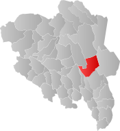
 Åmot within Innlandet | |
| Coordinates: 61°8′47″N 11°24′57″E / 61.14639°N 11.41583°ECoordinates: 61°8′47″N 11°24′57″E / 61.14639°N 11.41583°E | |
| Country | Norway |
| County | Innlandet |
| District | Østerdalen |
| Established | 1 January 1838 |
| • Created as | Formannskapsdistrikt |
| Administrative centre | Rena |
| Government | |
| • Mayor (2019) | Ole Erik Hørstad (H) |
| Area | |
| • Total | 1,339.93 km2 (517.35 sq mi) |
| • Land | 1,293.32 km2 (499.35 sq mi) |
| • Water | 46.61 km2 (18.00 sq mi) 3.5% |
| • Rank | #72 in Norway |
| Population (2022) | |
| • Total | 4,195 |
| • Rank | #198 in Norway |
| • Density | 3.2/km2 (8/sq mi) |
| • Change (10 years) | |
| Demonym | Åmoting[1] |
| Official language | |
| • Norwegian form | Bokmål |
| Time zone | UTC+01:00 (CET) |
| • Summer (DST) | UTC+02:00 (CEST) |
| ISO 3166 code | NO-3422 |
| Website | Official website |
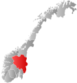
Åmot is a municipality in Innlandet county, Norway. It is located in the traditional district of Østerdalen. The administrative centre of the municipality is the village of Rena. Other villages in the municipality include Åsta, Osneset, and Snippen.[3]
The 1,340-square-kilometre (520 sq mi) municipality is the 72nd largest by area out of the 356 municipalities in Norway. Åmot is the 198th most populous municipality in Norway with a population of 4,195. The municipality's population density is 3.2 inhabitants per square kilometre (8.3/sq mi) and its population has decreased by 3.3% over the previous 10-year period.[4][5]
General information
The parish of Aamot (later spelled Åmot) was established as a municipality on 1 January 1838 (see formannskapsdistrikt law). In 1880, the Nordre Osen area of Trysil (population: 302) was transferred to Åmot municipality.[6]
Name
The municipality (originally the parish) is named after the old Åmot farm (Old Norse: Ámót), since the first Åmot Church was built here. The first element is á which means "river" and the last element is mót meaning "meeting". Thus the name means the meeting of the rivers (the confluence of the rivers Glomma and Rena is in Åmot). Prior to 1921, the name was written "Aamot".[7]
Coat of arms
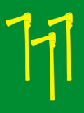
The coat of arms was granted on 26 February 1988. The arms show three gold or yellow timber axes on a green background. They symbolize the importance and history of the logging industry in the area.[8][9]
Churches
The Church of Norway has three parishes (sokn) within the municipality of Åmot. It is part of the Sør-Østerdal prosti (deanery) in the Diocese of Hamar.
| Parish (sokn) | Church name | Location of the church | Year built |
|---|---|---|---|
| Deset | Deset Church | Deset | 1867 |
| Nordre Osen | Nordre Osen Church | Osneset | 1923 |
| Old Nordre Osen Church | Osneset | 1777 | |
| Åmot | Åmot Church | Rena | 1901 |
Education
Åmot has four schools: Åmot Ungdomsskole (Åmot Lower secondary school), Rena Barneskole, Deset Oppvekstsenter, and Osen Oppvekstsenter.
Government
All municipalities in Norway, including Åmot, are responsible for primary education (through 10th grade), outpatient health services, senior citizen services, unemployment and other social services, zoning, economic development, and municipal roads. The municipality is governed by a municipal council of elected representatives, which in turn elects a mayor.[10] The municipality falls under the Østre Innlandet District Court and the Eidsivating Court of Appeal.
Municipal council
The municipal council (Kommunestyre) of Åmot is made up of 19 representatives that are elected to four year terms. The party breakdown of the council is as follows:
| Party Name (in Norwegian) | Number of representatives | |
|---|---|---|
| Labour Party (Arbeiderpartiet) | 6 | |
| Progress Party (Fremskrittspartiet) | 1 | |
| Conservative Party (Høyre) | 2 | |
| Centre Party (Senterpartiet) | 8 | |
| Socialist Left Party (Sosialistisk Venstreparti) | 2 | |
| Total number of members: | 19 | |
| Party Name (in Norwegian) | Number of representatives | |
|---|---|---|
| Labour Party (Arbeiderpartiet) | 5 | |
| Progress Party (Fremskrittspartiet) | 1 | |
| Conservative Party (Høyre) | 2 | |
| Centre Party (Senterpartiet) | 9 | |
| Socialist Left Party (Sosialistisk Venstreparti) | 2 | |
| Total number of members: | 19 | |
| Party Name (in Norwegian) | Number of representatives | |
|---|---|---|
| Labour Party (Arbeiderpartiet) | 7 | |
| Progress Party (Fremskrittspartiet) | 2 | |
| Conservative Party (Høyre) | 3 | |
| Pensioners' Party (Pensjonistpartiet) | 1 | |
| Centre Party (Senterpartiet) | 8 | |
| Socialist Left Party (Sosialistisk Venstreparti) | 1 | |
| Liberal Party (Venstre) | 1 | |
| Total number of members: | 23 | |
| Party Name (in Norwegian) | Number of representatives | |
|---|---|---|
| Labour Party (Arbeiderpartiet) | 4 | |
| Progress Party (Fremskrittspartiet) | 2 | |
| Conservative Party (Høyre) | 1 | |
| Centre Party (Senterpartiet) | 8 | |
| Socialist Left Party (Sosialistisk Venstreparti) | 1 | |
| Liberal Party (Venstre) | 1 | |
| Total number of members: | 17 | |
| Party Name (in Norwegian) | Number of representatives | |
|---|---|---|
| Labour Party (Arbeiderpartiet) | 5 | |
| Progress Party (Fremskrittspartiet) | 2 | |
| Conservative Party (Høyre) | 3 | |
| Centre Party (Senterpartiet) | 4 | |
| Socialist Left Party (Sosialistisk Venstreparti) | 3 | |
| Total number of members: | 17 | |
| Party Name (in Norwegian) | Number of representatives | |
|---|---|---|
| Labour Party (Arbeiderpartiet) | 6 | |
| Progress Party (Fremskrittspartiet) | 2 | |
| Conservative Party (Høyre) | 5 | |
| Centre Party (Senterpartiet) | 6 | |
| Socialist Left Party (Sosialistisk Venstreparti) | 4 | |
| Total number of members: | 23 | |
| Party Name (in Norwegian) | Number of representatives | |
|---|---|---|
| Labour Party (Arbeiderpartiet) | 8 | |
| Conservative Party (Høyre) | 2 | |
| Centre Party (Senterpartiet) | 10 | |
| Socialist Left Party (Sosialistisk Venstreparti) | 3 | |
| Total number of members: | 23 | |
| Party Name (in Norwegian) | Number of representatives | |
|---|---|---|
| Labour Party (Arbeiderpartiet) | 9 | |
| Conservative Party (Høyre) | 2 | |
| Centre Party (Senterpartiet) | 6 | |
| Socialist Left Party (Sosialistisk Venstreparti) | 6 | |
| Total number of members: | 23 | |
| Party Name (in Norwegian) | Number of representatives | |
|---|---|---|
| Labour Party (Arbeiderpartiet) | 11 | |
| Conservative Party (Høyre) | 2 | |
| Centre Party (Senterpartiet) | 4 | |
| Joint list of the Socialist Left Party (Sosialistisk Venstreparti) and the Communist Party (Kommunistiske Parti) | 6 | |
| Total number of members: | 23 | |
| Party Name (in Norwegian) | Number of representatives | |
|---|---|---|
| Labour Party (Arbeiderpartiet) | 11 | |
| Conservative Party (Høyre) | 2 | |
| Communist Party (Kommunistiske Parti) | 1 | |
| Centre Party (Senterpartiet) | 4 | |
| Socialist Left Party (Sosialistisk Venstreparti) | 5 | |
| Total number of members: | 23 | |
| Party Name (in Norwegian) | Number of representatives | |
|---|---|---|
| Labour Party (Arbeiderpartiet) | 11 | |
| Conservative Party (Høyre) | 3 | |
| Communist Party (Kommunistiske Parti) | 1 | |
| Centre Party (Senterpartiet) | 3 | |
| Socialist Left Party (Sosialistisk Venstreparti) | 5 | |
| Total number of members: | 23 | |
| Party Name (in Norwegian) | Number of representatives | |
|---|---|---|
| Labour Party (Arbeiderpartiet) | 11 | |
| Conservative Party (Høyre) | 2 | |
| Centre Party (Senterpartiet) | 4 | |
| Socialist Left Party (Sosialistisk Venstreparti) | 6 | |
| Total number of members: | 23 | |
| Party Name (in Norwegian) | Number of representatives | |
|---|---|---|
| Labour Party (Arbeiderpartiet) | 12 | |
| Conservative Party (Høyre) | 1 | |
| Centre Party (Senterpartiet) | 4 | |
| Socialist common list (Venstresosialistiske felleslister) | 6 | |
| Total number of members: | 23 | |
| Party Name (in Norwegian) | Number of representatives | |
|---|---|---|
| Labour Party (Arbeiderpartiet) | 12 | |
| Conservative Party (Høyre) | 1 | |
| Communist Party (Kommunistiske Parti) | 5 | |
| Centre Party (Senterpartiet) | 3 | |
| Socialist People's Party (Sosialistisk Folkeparti) | 1 | |
| Liberal Party (Venstre) | 1 | |
| Total number of members: | 23 | |
| Party Name (in Norwegian) | Number of representatives | |
|---|---|---|
| Labour Party (Arbeiderpartiet) | 12 | |
| Conservative Party (Høyre) | 2 | |
| Communist Party (Kommunistiske Parti) | 6 | |
| Centre Party (Senterpartiet) | 3 | |
| Total number of members: | 23 | |
| Party Name (in Norwegian) | Number of representatives | |
|---|---|---|
| Labour Party (Arbeiderpartiet) | 10 | |
| Conservative Party (Høyre) | 1 | |
| Communist Party (Kommunistiske Parti) | 8 | |
| Centre Party (Senterpartiet) | 4 | |
| Total number of members: | 23 | |
| Party Name (in Norwegian) | Number of representatives | |
|---|---|---|
| Labour Party (Arbeiderpartiet) | 9 | |
| Conservative Party (Høyre) | 2 | |
| Communist Party (Kommunistiske Parti) | 9 | |
| Farmers' Party (Bondepartiet) | 3 | |
| Total number of members: | 23 | |
| Party Name (in Norwegian) | Number of representatives | |
|---|---|---|
| Labour Party (Arbeiderpartiet) | 9 | |
| Communist Party (Kommunistiske Parti) | 8 | |
| Farmers' Party (Bondepartiet) | 3 | |
| Total number of members: | 20 | |
| Party Name (in Norwegian) | Number of representatives | |
|---|---|---|
| Labour Party (Arbeiderpartiet) | 8 | |
| Communist Party (Kommunistiske Parti) | 7 | |
| Joint List(s) of Non-Socialist Parties (Borgerlige Felleslister) | 5 | |
| Total number of members: | 20 | |
| Party Name (in Norwegian) | Number of representatives | |
|---|---|---|
| Labour Party (Arbeiderpartiet) | 7 | |
| Communist Party (Kommunistiske Parti) | 9 | |
| Joint List(s) of Non-Socialist Parties (Borgerlige Felleslister) | 4 | |
| Total number of members: | 20 | |
| Party Name (in Norwegian) | Number of representatives | |
|---|---|---|
| Labour Party (Arbeiderpartiet) | 8 | |
| Communist Party (Kommunistiske Parti) | 7 | |
| Joint List(s) of Non-Socialist Parties (Borgerlige Felleslister) | 5 | |
| Total number of members: | 20 | |
| Note: Due to the German occupation of Norway during World War II, no elections were held for new municipal councils until after the war ended in 1945. | ||
Mayor
| Ancestry | Number |
|---|---|
| 60 | |
| 29 | |
| 28 | |
| 24 | |
| 23 |
The mayors of Åmot (incomplete list):
- 2003-2011: Ole Gustav Narud (Sp)
- 2011-2015: Espen André Kristiansen (Ap)
- 2015-2019: Ole Gustav Narud (Sp)
- 2019–present: Ole Erik Hørstad[31] (H)
Geography
Åmot is located in the east-central part of Innlandet county. It is bordered to the north by the municipality of Rendalen, to the east by Trysil, to the south by Elverum, to the southwest by Hamar and Ringsaker, and in the west by Stor-Elvdal.
The Renaelva and Julussa rivers are both tributaries of the large river Glomma, all three of which flow through Åmot. The Kjøllsæter Bridge crosses the river Renaelva, just north of its confluence with the Julussa river. The Julussdalen valley follows the river Julussa through the municipality.
Notable people
- Vilhelm Uchermann (1852 in Åmot – 1929) a physician, Norway's first otorhinolaryngologist
- Tollef Kilde (1853 in Åmot – 1947) a forest owner, politician and local Mayor ca.1900
- Hans Storhaug, MM, DSM (1915 in Rena – 1995) a Norwegian resistance member during WWII
- Vidar Sandbeck (1918 in Åmot – 2005) a Norwegian folk singer, composer and writer
- Anne-Cath. Vestly (1920 in Rena – 2008) a Norwegian author of children's literature
- Ivar Nergaard (born 1964 in Rena) a Norwegian actor and writer [32]
- Stian Berget (born 1977 in Rena) a retired Norwegian footballer with almost 200 club caps
- Tuva Novotny (born 1979) a Swedish actress, director and singer; brought up in Åmot [33]
References
- ^ "Navn på steder og personer: Innbyggjarnamn" (in Norwegian). Språkrådet.
- ^ "Forskrift om målvedtak i kommunar og fylkeskommunar" (in Norwegian). Lovdata.no.
- ^ Thorsnæs, Geir, ed. (2 July 2021). "Åmot". Store norske leksikon (in Norwegian). Kunnskapsforlaget. Retrieved 6 March 2022.
- ^ Statistisk sentralbyrå. "Table: 06913: Population 1 January and population changes during the calendar year (M)" (in Norwegian).
- ^ Statistisk sentralbyrå. "09280: Area of land and fresh water (km²) (M)" (in Norwegian).
- ^ Jukvam, Dag (1999). "Historisk oversikt over endringer i kommune- og fylkesinndelingen" (PDF) (in Norwegian). Statistisk sentralbyrå.
- ^ Rygh, Oluf (1900). Norske gaardnavne: Hedmarkens amt (in Norwegian) (3 ed.). Kristiania, Norge: W. C. Fabritius & sønners bogtrikkeri. pp. 342–343.
- ^ "Kommunevåpen" (in Norwegian). Åmot kommune. Retrieved 20 December 2008.
- ^ "Civic heraldry of Norway - Norske Kommunevåpen". Heraldry of the World. Retrieved 6 March 2022.
- ^ Hansen, Tore, ed. (12 May 2016). "kommunestyre". Store norske leksikon (in Norwegian). Kunnskapsforlaget. Retrieved 30 January 2022.
- ^ "Tall for Norge: Kommunestyrevalg 2019 - Innlandet". Valg Direktoratet. Retrieved 6 March 2022.
- ^ "Tall for Norge: Kommunestyrevalg 2015 - Hedmark". Valg Direktoratet.
- ^ a b c d "Table: 04813: Members of the local councils, by party/electoral list at the Municipal Council election (M)" (in Norwegian). Statistics Norway.
- ^ "Tall for Norge: Kommunestyrevalg 2011 - Hedmark". Valg Direktoratet.
- ^ "Kommunestyrevalget 1995" (PDF) (in Norwegian). Oslo-Kongsvinger: Statistisk sentralbyrå. 1996.
- ^ "Kommunestyrevalget 1991" (PDF) (in Norwegian). Oslo-Kongsvinger: Statistisk sentralbyrå. 1993.
- ^ "Kommunestyrevalget 1987" (PDF) (in Norwegian). Oslo-Kongsvinger: Statistisk sentralbyrå. 1988.
- ^ "Kommunestyrevalget 1983" (PDF) (in Norwegian). Oslo-Kongsvinger: Statistisk sentralbyrå. 1984.
- ^ "Kommunestyrevalget 1979" (PDF) (in Norwegian). Oslo: Statistisk sentralbyrå. 1979.
- ^ "Kommunevalgene 1975" (PDF) (in Norwegian). Oslo: Statistisk sentralbyrå. 1977.
- ^ "Kommunevalgene 1972" (PDF) (in Norwegian). Oslo: Statistisk sentralbyrå. 1973.
- ^ "Kommunevalgene 1967" (PDF) (in Norwegian). Oslo: Statistisk sentralbyrå. 1967.
- ^ "Kommunevalgene 1963" (PDF) (in Norwegian). Oslo: Statistisk sentralbyrå. 1964.
- ^ "Kommunevalgene og Ordførervalgene 1959" (PDF) (in Norwegian). Oslo: Statistisk sentralbyrå. 1960.
- ^ "Kommunevalgene og Ordførervalgene 1955" (PDF) (in Norwegian). Oslo: Statistisk sentralbyrå. 1957.
- ^ "Kommunevalgene og Ordførervalgene 1951" (PDF) (in Norwegian). Oslo: Statistisk sentralbyrå. 1952.
- ^ "Kommunevalgene og Ordførervalgene 1947" (PDF) (in Norwegian). Oslo: Statistisk sentralbyrå. 1948.
- ^ "Kommunevalgene og Ordførervalgene 1945" (PDF) (in Norwegian). Oslo: Statistisk sentralbyrå. 1947.
- ^ "Kommunevalgene og Ordførervalgene 1937" (PDF) (in Norwegian). Oslo: Statistisk sentralbyrå. 1938.
- ^ "Immigrants and Norwegian-born to immigrant parents, by immigration category, country background and percentages of the population". ssb.no. Archived from the original on 2 July 2015. Retrieved 29 June 2015.
- ^ "(+) Ole Erik ble eneste Høyre-ordfører i Innlandet. Vil ikke si om han har tillit til rådmannen". www.ostlendingen.no (in Norwegian). 3 October 2019. Retrieved 6 October 2019.
- ^ IMDb Database retrieved 24 September 2020
- ^ IMDb Database retrieved 24 September 2020
External links
 Media related to Åmot at Wikimedia Commons
 The dictionary definition of Åmot at Wiktionary
- Municipal fact sheet from Statistics Norway (in Norwegian)
- Pages with non-numeric formatnum arguments
- CS1 Norwegian-language sources (no)
- Articles with short description
- Coordinates not on Wikidata
- Official website not in Wikidata
- Articles containing Old Norse-language text
- Articles containing Norwegian-language text
- Articles containing Bokmål-language text
- Commons category link is defined as the pagename
- Articles with Norwegian-language sources (no)
- AC with 0 elements
- Use dmy dates from March 2022
- Åmot
- Municipalities of Innlandet
- 1838 establishments in Norway


