Sapa-Sapa
(Redirected from Sapa-sapa, Tawi-Tawi)
Sapa-Sapa
ساڤ-ساڤ | |
|---|---|
OpenStreetMap | |
| Country | Philippines |
| Barangays | (see Barangays) |
| Government | |
| • Mayor | Rhodesia M. Sali |
| • Vice Mayor | Karim Darwis J. Masdal |
| • Representative | Dimszar M. Sali |
| • Municipal Council | Members |
| • Electorate | voters (?) |
| Highest elevation | 529 m (1,736 ft) |
| Lowest elevation | 0 m (0 ft) |
| Economy | |
| • Poverty incidence | % (?) |
| Service provider | |
| • Electricity | — |
| Time zone | UTC+8 (PST) |
| PSGC | PSGC unknown |
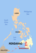
Sapa-Sapa, officially the Municipality of Sapa-Sapa, is a 3rd class municipality in the province of Tawi-Tawi, Philippines. According to the 2020 census, it has a population of 33,580. [3]
Geography
Barangays
Sapa-sapa is politically subdivided into 23 barangays.
- Baldatal
- Butun
- Dalo-Dalo
- Kohek
- Lakit-Lakit
- Latuan (Sunsang)
- Banaran Lookan
- Look Natoh
- Lookan Latuan
- Malanta
- Tambunan
- Sikubong
- Palatih Gadjaminah
- Pamasan
- Sapaat
- Sapa-Sapa (Poblacion)
- Sokah-sokah
- Bukut Sikubong
- Tangngah Deom Sikubong
- Tapian Bohe North
- Tapian Bohe South
- Banaran Tunggusong
- Mantabuan Sannang Hati
- Lookan Tup-Tup
Panampangan Island
Panampangan Island is located in the municipality of Sapa-sapa. The island itself is famous for its sandbar which is considered[by whom?] the longest in the Philippines.[citation needed]
At low tide, the sandbar connects to the nearby islet of Panampangan island.
Climate
| Climate data for Sapa-Sapa, Tawi-Tawi | |||||||||||||
|---|---|---|---|---|---|---|---|---|---|---|---|---|---|
| Month | Jan | Feb | Mar | Apr | May | Jun | Jul | Aug | Sep | Oct | Nov | Dec | Year |
| Average high °C (°F) | 29 (84) |
29 (84) |
29 (84) |
30 (86) |
30 (86) |
30 (86) |
29 (84) |
30 (86) |
30 (86) |
30 (86) |
29 (84) |
29 (84) |
30 (85) |
| Average low °C (°F) | 25 (77) |
24 (75) |
24 (75) |
25 (77) |
25 (77) |
25 (77) |
25 (77) |
25 (77) |
25 (77) |
25 (77) |
25 (77) |
25 (77) |
25 (77) |
| Average precipitation mm (inches) | 157 (6.2) |
115 (4.5) |
123 (4.8) |
96 (3.8) |
136 (5.4) |
120 (4.7) |
104 (4.1) |
89 (3.5) |
86 (3.4) |
131 (5.2) |
151 (5.9) |
159 (6.3) |
1,467 (57.8) |
| Average rainy days | 20.4 | 17.5 | 20.4 | 21.1 | 26.7 | 25.7 | 26.0 | 24.5 | 24.0 | 27.7 | 26.3 | 24.7 | 285 |
| Source: Meteoblue[4] | |||||||||||||
Demographics
| Year | Pop. | ±% p.a. |
|---|---|---|
| Source: Philippine Statistics Authority [5] [6] [7] | ||
Economy
References
- ^
- ^ "2015 Census of Population, Report No. 3 – Population, Land Area, and Population Density" (PDF). Philippine Statistics Authority. Quezon City, Philippines. August 2016. ISSN 0117-1453. Archived (PDF) from the original on May 25, 2021. Retrieved July 16, 2021.
- ^ a b Census of Population (2020). Table B - Population and Annual Growth Rates by Province, City, and Municipality - By Region. PSA. Retrieved 8 July 2021.
- ^ "Sapa-Sapa, Tawi-Tawi : Average Temperatures and Rainfall". Meteoblue. Retrieved 30 January 2019.
- ^ Census of Population (2015). Highlights of the Philippine Population 2015 Census of Population. PSA. Retrieved 20 June 2016.
- ^ Census of Population and Housing (2010). Population and Annual Growth Rates for The Philippines and Its Regions, Provinces, and Highly Urbanized Cities (PDF). NSO. Retrieved 29 June 2016.
- ^ Censuses of Population (1903–2007). Table 1. Population Enumerated in Various Censuses by Region: 1903 to 2007. NSO.
External links
- Sapa-Sapa Profile at PhilAtlas.com
- String Module Error: String subset index out of range000®code=String Module Error: String subset index out of range&provcode=String Module Error: String subset index out of range Philippine Standard Geographic Code
- Sapa-Sapa Profile at the DTI Cities and Municipalities Competitive Index
- Philippine Census Information
Categories:
- Pages using the Graph extension
- Articles with short description
- Pages using PH wikidata incorrectly
- Philippine articles requiring maintenance
- Pages using infobox settlement with image map1 but not image map
- Pages using infobox settlement with no coordinates
- Articles with specifically marked weasel-worded phrases from September 2019
- All articles with unsourced statements
- Articles with unsourced statements from September 2019
- Errors reported by Module String
- AC with 0 elements
- Municipalities of Tawi-Tawi
- All stub articles
- Bangsamoro geography stubs
