Sankt Hans backar

Sankt Hans backar is a park and recreational area on a hill located in Lund, Skåne, in the southernmost part of Sweden. The top of the hill reaches 85 metres (279 ft) above sea level.
The hill is a former municipal dump, opened in 1947, which was in use until 1954.[1] The recreational area was constructed in the 1970s, giving the area its current form.[1] Pollution remained an issue – the Valkärra stream, which flows through the park, was contaminated by leaking water, leading to fish mutations[2] – and the municipality financed a new decontamination project, starting in 2013, to protect water bodies in the area.[3]
The park is the largest urban green space in Lund, surrounded by residential areas. It is a popular vantage point, offering a view of the town and its surroundings towards Öresund. Lundakarnevalen use the place to organize social events. There is an annual hill running competition, Sankt Hans Extreme, in the hills.[4] An amphitheatre is planned to be constructed in the hills.[5] The area is used by surrounding schools and preschools as an outdoor classroom.[6]

Vallkärra stream
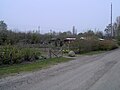
Allotment gardens

View over the Annehem, northward

The view over the Norra Nöbbelöv, westward


References
- ^ a b "Giftigt "surhål" ska åtgärdas". Skånska Dagbladet (in Swedish). 21 September 2011.
- ^ Gustavsson, Johanna (29 July 2007). "Missbildad öring vittnar om miljögifter". Sydsvenskan. Archived from the original on 2012-03-09. Retrieved 2007-07-31.
- ^ Sjögren, Alf (24 September 2014). "Nu renas vattnet på Sankt Hans backar". Sydsvenskan (in Swedish). p. C2.
- ^ "Backkraftprov för 9:e gången". Sydsvenskan (in Swedish). 22 May 2012. p. C3.
- ^ Hörnell, Anna (10 March 2021). "Sankt Hans backar får ett ansiktslyft". Sydsvenskan (in Swedish). pp. B2–B3.
- ^ "Utvecklingsplanen för rekreationsområdet Sankt Hans backar i norra Lund antaget". Sport- och fritidsnyheter (in Swedish). 11 March 2021.
Coordinates: 55°43′22″N 13°11′33″E / 55.72278°N 13.19250°E