Pothohar Plateau
| Pothohar Plateau | |
|---|---|
| Punjabi: سطح مرتفع پوٹھوہار | |
 | |
| Highest point | |
| Elevation | 1,900 ft (580 m)[1] |
| Geography | |
| Range coordinates | 32°58′N 72°15′E / 32.967°N 72.250°ECoordinates: 32°58′N 72°15′E / 32.967°N 72.250°E[2] |
| Geology | |
| Mountain type | Plateau |
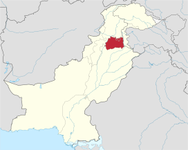
The Pothohar Plateau (Urdu: سطح مرتفع پوٹھوہار) is a plateau in north-eastern Pakistan, located between Indus River and the Jhelum River, forming the northern part of Punjab.[3][4]
Geography
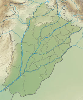
Potohar Plateau is bounded on the east by the Jhelum River, on the west by the Indus River, on the north by the Kala Chitta Range and the Margalla Hills, and on the south by the Salt Range.[3] The Kala Chitta Range thrusts eastward across the plateau towards Rawalpindi; the valleys of the Haro and Soan rivers cross the plateau from the eastern foothills to the Indus. The ramparts of the Salt Range stretching from east to west in the south separate Potohar from the Punjab Plain. The Potwar Plateau includes parts of the current four districts of Jhelum, Chakwal, Attock and Rawalpindi.[4] The terrain is undulating. The Kala Chitta Range rises to an average height of 450–900 meters and extends for about 72 kilometers. The Swaan River starts from nearby Murree and ends near Kalabagh in the Indus river. Sakesar (Khushab District) is the highest mountain of this region and Tilla Jogian in Jhelum is second highest. Most of the hills and rivers are bordered by dissected ravine belts. The streams, due to constant rejuvenation, are deep-set and of little use for irrigation.
The diverse wildlife includes urial, chinkara, chukar, hare, mongoose, wild boar, and yellow-throated marten. The Sivapithecus indicus fossil skull of an extinct ape species was discovered in Potohar plateau.[5]
Economy
Agriculture is dependent largely on rainfall, which averages 380–500 mm annually; rainfall is greatest in the northwest and declines to arid conditions in the southwest. The chief crops are wheat, barley, sorghum, and legumes, onions, melons, and tobacco are grown in the more fertile areas near the River Indus.
The plateau is the location of major Pakistani oil fields, the first of which were discovered at Khaur (1915) and Dhuliān (1935); the Tut field was discovered in 1968, Missa Keswal was discovered in 1992 and exploration continued in the area in the 1990s. The oil fields are connected by pipeline to the Attock Refinery in Rawalpindi.[6] Major reserves of oil and gas has been discovered at Chak Beli Khan near Rawalpindi in Punjab.
A major oil reserve has been discovered near Jhelum in Punjab, opening up a new area for exploitation of hydrocarbon potential (e.g., Meyal Field[7]). With an estimated production of 5,500 barrels per day, the Ghauri X-1 oil well is expected to be the country’s largest oil-producing well and is likely to start contributing its output to the system by the end of June 2014. Due to low rain fall, extensive deforestation, coal mining, oil and gas exploration, the area is becoming devoid of vegetation. The under water areas of lakes (Uchali, Khabeki, Jhallar and Kallar Kahar) have been reduced to much smaller areas than in the past.
This region also lends the name to the Suzuki Jimny SJ-410 model, which was branded as the Suzuki Potohar for the Pakistani market.
The major cities of Islamabad and Rawalpindi, and the smaller cities of Choa Saidanshah, Kallar Syedan, Chakwal, Gujar Khan, Sohawa, and Attock are situated on the plateau.
Important sites
Taxila
Taxila's archaeological sites lie near modern Taxila about 35 km (22 mi) northwest of the city of Rawalpindi.[8] The sites were first excavated by John Marshall, who worked at Taxila over a period of twenty years from 1913.[9]
The vast archaeological site includes neolithic remains dating to 3360 BCE, and Early Harappan remains dating to 2900–2600 BCE at Sarai Kala.[10] Taxila, however, is most famous for ruins of several settlements, the earliest dating from around 1000 BCE. It is also known for its collection of Buddhist religious monuments, including the Dharmarajika stupa, the Jaulian monastery, and the Mohra Muradu monastery.
The main ruins of Taxila include four major cities, each belonging to a distinct time period, at three different sites. The earliest settlement at Taxila is found in the Hathial section, which yielded pottery shards that date from as early as the late 2nd millennium BCE to the 6th century BCE. The Bhir Mound ruins at the site date from the 6th century BCE, and are adjacent to Hathial. The ruins of Sirkap date to the 2nd century BCE, and were built by the region's Greco-Bactrian kings who ruled in the region following Alexander the Great's invasion of the region in 326 BCE. The third and most recent settlement is that of Sirsukh, which was built by rulers of the Kushan empire, who ruled from nearby Purushapura (modern Peshawar).
Rohtas Fort

Rohtas Fort is a 16th-century fortress located near the city of Jhelum in the Punjab province of Pakistan. The fort is one of the largest and most formidable in the subcontinent.[11] Rohtas Fort was never taken by force,[12] and it has remained remarkably intact.[12]
The fortress was built by Raja Todar Mal on the orders of Sher Shah Suri.
The fort is known for its large defensive walls and several monumental gateways. Rohtas Fort was declared a UNESCO World Heritage Site in 1997, as an "exceptional example of the Muslim military architecture of Central and South Asia."[12]
Katas Raj Temples
The Katas Raj Temples also known as Qila Katas,[13] is a complex of several Hindu temples connected to one another by walkways.[13] The temple complex surrounds a pond named Katas which is regarded as sacred by Hindus.[14]
The temples' pond is said in the Puranas to have been created from the teardrops of Shiva, after he wandered the Earth inconsolable after the death of his wife Sati.[14][13] The pond occupies an area of two kanals and 15 marlas, with a maximum depth of 20 feet.
The temples play a role in the Hindu epic poem, the Mahābhārata,[15] where the temples are traditionally believed to have been the site where the Pandava brothers spent a significant portion of their exile.[14]
Rawat Fort
Rawat Fort is an early 16th century fort in the Pothohar plateau of Pakistan, near the city of Rawalpindi in the province of Punjab. The fort was built to defend the Pothohar plateau from the forces of the Pashtun king Sher Shah Suri.[16]
See also
References
- ^ Tikekar, Maneesha (2004). Across the Wagah: An Indian's Sojourn in Pakistan. Bibliophile South Asia. p. 180. ISBN 978-81-85002-34-7.
- ^ Öztürk, Münir Ahmet; Khan, Shujaul Mulk; Altay, Volkan; Efe, Recep; Egamberdieva, Dilfuza; Khassanov, Furkat O. (2022). Biodiversity, Conservation and Sustainability in Asia: Volume 2: Prospects and Challenges in South and Middle Asia. Springer Nature. p. 912. ISBN 978-3-030-73943-0.
- ^ a b Tikekar, Maneesha (2004). Across the Wagah: An Indian's Sojourn in Pakistan. Bibliophile South Asia. p. 180. ISBN 978-81-85002-34-7.
- ^ a b Öztürk, Münir Ahmet; Khan, Shujaul Mulk; Altay, Volkan; Efe, Recep; Egamberdieva, Dilfuza; Khassanov, Furkat O. (2022). Biodiversity, Conservation and Sustainability in Asia: Volume 2: Prospects and Challenges in South and Middle Asia. Springer Nature. p. 912. ISBN 978-3-030-73943-0.
- ^ A partial hominoid innominate from the Miocene of Pakistan: Description and preliminary analyses
- ^ "New Page 1".
- ^ Riaz, Muhammad; Nuno, Pimentel; Zafar, Tehseen; Ghazi, Shahid (2019). "2D Seismic Interpretation of the Meyal Area, Northern Potwar Deform Zone, Potwar Basin, Pakistan". Open Geosciences. 11 (1): 1–16. doi:10.1515/geo-2019-0001.
- ^ "Taxila | ancient city, Pakistan | Britannica". www.britannica.com. Retrieved 2022-08-17.
- ^ Wheeler, Mortimer. "Marshall, Sir John Hubert (1876–1958)". Oxford Dictionary of National Biography (online ed.). Oxford University Press. doi:10.1093/ref:odnb/34896. Retrieved 4 July 2017. (Subscription or UK public library membership required.)
- ^ Allchin & Allchin 1988, p. 127.
- ^ "Pakistan: Rohtas Fort". World Archaeology (17). 7 May 2006.
- ^ a b c "Rohtas Fort". UNESCO. Retrieved 26 May 2017.
- ^ a b c Khalid, Laiba (2015). "Explore Rural India" (PDF). 3 (1). The Indian Trust for Rural Heritage and Development: 55–57. Archived from the original (PDF) on 30 April 2016. Retrieved 15 September 2017.
{{cite journal}}: Cite journal requires|journal=(help) - ^ a b c Sah, Krishna Kumar (2016). Deva Bhumi: The Abode of the Gods in India. BookBaby. p. 79. ISBN 9780990631491. Retrieved 15 September 2017.
- ^ Directorate General of Archaeology. "KATAS RAJ TEMPLES". Government of Punjab.
- ^ Malik, Iftikhar Haider (2006). Culture and Customs of Pakistan. Greenwood Publishing Group. ISBN 9780313331268.
External links
- . Encyclopædia Britannica. Vol. 15 (11th ed.). 1911. p. 413.
- . Encyclopædia Britannica. Vol. 12 (11th ed.). 1911. p. 713.
- Potwar Plateau – Encyclopædia Britannica from Encyclopædia Britannica Premium Service
- Regional Studies of the Potwar Plateau Area, Northern Pakistan United States Geological Survey
BoilerPlate was here
- Harv and Sfn no-target errors
- CS1 errors: missing periodical
- Articles with short description
- Articles containing Urdu-language text
- Coordinates not on Wikidata
- Commons category link is defined as the pagename
- AC with 0 elements
- Archaeological sites in Pakistan
- Archaeological sites in Punjab, Pakistan
- Geography of Pakistan
- Geography of Punjab, Pakistan
- Landforms of Pakistan
- Landforms of Punjab (Pakistan)
- Landforms of Azad Kashmir
- Plateaus of Pakistan
- Regions of Punjab, Pakistan


