Kugluktuk
Kugluktuk
Qurluqtuq ᖁᕐᓗᖅᑐᖅ | |
|---|---|
 Hill top view of Kugluktuk | |
 Kugluktuk  Kugluktuk | |
| Coordinates: 67°49′36″N 115°05′36″W / 67.82667°N 115.09333°W[1]Coordinates: 67°49′36″N 115°05′36″W / 67.82667°N 115.09333°W[1] | |
| Country | Canada |
| Territory | Nunavut |
| Region | Kitikmeot |
| Electoral district | Kugluktuk |
| Government | |
| • Mayor | Simon Kuliktana[2] |
| • MLA | Bobby Anavilok |
| Area (2021)[5] | |
| • Land | 538.99 km2 (208.11 sq mi) |
| Elevation | 23 m (75 ft) |
| Population (2021)[5] | |
| • Total | 1,382 |
| • Density | 2.6/km2 (7/sq mi) |
| • DPL[7] | 956 |
| Time zone | UTC−07:00 (MST) |
| • Summer (DST) | UTC−06:00 (MDT) |
| Canadian Postal code | |
| Area code | 867 |
Kugluktuk (Qurluktuk, lit. '"the place of moving water"'; Inuktitut syllabics: ᖁᕐᓗᖅᑐᖅ; Inuktitut pronunciation: [quʁluqtuq]), formerly known as Coppermine until 1 January 1996, is a hamlet located at the mouth of the Coppermine River in the Kitikmeot Region of Nunavut, Canada, on Coronation Gulf, southwest of Victoria Island. It is the westernmost community in Nunavut, near the border with the Northwest Territories.
The traditional language of the area is Inuinnaqtun and is written using the Latin alphabet, rather than the syllabics of the Inuktitut writing system. Like Cambridge Bay, Bathurst Inlet, and Umingmaktok, syllabics are rarely seen and are used mainly by the Government of Nunavut.
History
In 1982, a division plebiscite was held. While approximately 80% of the population in what is now Nunavut voted in favour of division, Coppermine was one of only two communities to vote against division. Cambridge Bay was the other.[8] In June 2004, a fuel line broke in the centre of Kugluktuk, spilling 2,000 L (440 imp gal; 530 US gal) of diesel fuel.[citation needed]
Geography
Kugluktuk is located on the shore of the Arctic Ocean. The surrounding landscape is dominated by the rocky and often barren Canadian Shield. The region has a subarctic climate, but barely so, with July having an average of 10.9 °C (51.6 °F). It has very cold and extremely dry winters, and moderate snowfall which is relatively high for its latitude. Though trees do exist in the region, they are dwarfed and extremely sparse.
Flora
Plant growth in the region during summer months includes small shrubs, grass, moss, lichens, blueberries, blackberries, cranberries, various flowers, and dwarf willow and birch trees.
Climate
Kugluktuk features a subarctic climate (Köppen climate classification: Dfc); like most of mainland Nunavut; with wet summers and dry winters. It is in the transitional zone to a cold tundra climate (ET), but falls outside of it, since its warmest month of July surpasses the 10 °C (50 °F) isotherm, averaging 10.9 °C (51.6 °F).
The highest temperature ever recorded in Kugluktuk was 34.9 °C (94.8 °F) on 15 July 1989.[9] The coldest temperature ever recorded was −50.0 °C (−58.0 °F) on 2 February 1968.[10]
| Climate data for Kugluktuk (Kugluktuk Airport) WMO ID: 71938; coordinates 67°49′00″N 115°08′38″W / 67.81667°N 115.14389°W; elevation: 22.6 m (74 ft); 1981–2010 normals, extremes 1930–present[a] | |||||||||||||
|---|---|---|---|---|---|---|---|---|---|---|---|---|---|
| Month | Jan | Feb | Mar | Apr | May | Jun | Jul | Aug | Sep | Oct | Nov | Dec | Year |
| Record high °C (°F) | 0.8 (33.4) |
1.1 (34.0) |
0.0 (32.0) |
9.8 (49.6) |
23.3 (73.9) |
32.5 (90.5) |
34.9 (94.8) |
30.3 (86.5) |
26.1 (79.0) |
13.9 (57.0) |
4.4 (39.9) |
−0.5 (31.1) |
34.9 (94.8) |
| Average high °C (°F) | −23.2 (−9.8) |
−23.4 (−10.1) |
−20.7 (−5.3) |
−11.4 (11.5) |
−1.3 (29.7) |
9.9 (49.8) |
15.6 (60.1) |
13.1 (55.6) |
6.5 (43.7) |
−3.5 (25.7) |
−14.8 (5.4) |
−20.3 (−4.5) |
−6.1 (21.0) |
| Daily mean °C (°F) | −27.3 (−17.1) |
−27.7 (−17.9) |
−25.3 (−13.5) |
−16.3 (2.7) |
−5.3 (22.5) |
5.5 (41.9) |
10.9 (51.6) |
9.0 (48.2) |
3.3 (37.9) |
−6.6 (20.1) |
−18.7 (−1.7) |
−24.5 (−12.1) |
−10.3 (13.5) |
| Average low °C (°F) | −31.4 (−24.5) |
−32.0 (−25.6) |
−29.8 (−21.6) |
−21.2 (−6.2) |
−9.2 (15.4) |
1.0 (33.8) |
6.1 (43.0) |
4.8 (40.6) |
0.1 (32.2) |
−9.8 (14.4) |
−22.6 (−8.7) |
−28.6 (−19.5) |
−14.4 (6.1) |
| Record low °C (°F) | −47.8 (−54.0) |
−50.0 (−58.0) |
−48.9 (−56.0) |
−43.9 (−47.0) |
−30.2 (−22.4) |
−15.0 (5.0) |
−0.8 (30.6) |
−4.4 (24.1) |
−20.0 (−4.0) |
−35.4 (−31.7) |
−41.1 (−42.0) |
−45.0 (−49.0) |
−50.0 (−58.0) |
| Average precipitation mm (inches) | 10.4 (0.41) |
8.4 (0.33) |
9.9 (0.39) |
10.0 (0.39) |
14.6 (0.57) |
16.6 (0.65) |
44.5 (1.75) |
45.1 (1.78) |
37.8 (1.49) |
26.5 (1.04) |
13.0 (0.51) |
10.4 (0.41) |
247.2 (9.73) |
| Average rainfall mm (inches) | 0.1 (0.00) |
0.0 (0.0) |
0.0 (0.0) |
0.1 (0.00) |
4.3 (0.17) |
14.6 (0.57) |
44.4 (1.75) |
44.9 (1.77) |
31.4 (1.24) |
4.7 (0.19) |
0.0 (0.0) |
0.0 (0.0) |
144.5 (5.69) |
| Average snowfall cm (inches) | 19.6 (7.7) |
16.3 (6.4) |
19.4 (7.6) |
18.2 (7.2) |
16.2 (6.4) |
2.1 (0.8) |
0.0 (0.0) |
0.2 (0.1) |
7.7 (3.0) |
35.0 (13.8) |
25.5 (10.0) |
21.9 (8.6) |
182.1 (71.7) |
| Average precipitation days (≥ 0.2 mm) | 8.9 | 8.7 | 10.0 | 8.2 | 7.5 | 7.6 | 11.5 | 13.3 | 12.8 | 14.3 | 11.1 | 9.7 | 123.4 |
| Average rainy days (≥ 0.2 mm) | 0.0 | 0.0 | 0.0 | 0.2 | 1.9 | 6.8 | 11.5 | 13.1 | 10.5 | 2.3 | 0.0 | 0.0 | 46.4 |
| Average snowy days (≥ 0.2 cm) | 10.5 | 10.1 | 11.6 | 9.5 | 7.2 | 1.3 | 0.1 | 0.2 | 3.7 | 14.5 | 13.4 | 11.6 | 93.6 |
| Average relative humidity (%) (at 1500 LST) | 76.7 | 75.1 | 77.5 | 82.3 | 83.1 | 70.2 | 64.8 | 69.8 | 75.5 | 84.7 | 80.9 | 77.8 | 76.5 |
| Mean monthly sunshine hours | 17.8 | 77.3 | 160.3 | 233.3 | 246.7 | 375.0 | 341.6 | 207.7 | 91.1 | 51.2 | 19.6 | 0.2 | 1,821.7 |
| Percent possible sunshine | 17.7 | 35.5 | 44.4 | 49.6 | 38.7 | 52.1 | 48.5 | 38.5 | 22.8 | 17.6 | 12.7 | 0.7 | 31.6 |
| Source: Environment and Climate Change Canada[9][11][12][13][14][15][16][17][18][19][20][21][22][10][23][24][25][26] | |||||||||||||
Demographics
As a census subdivision in the 2021 Canadian census conducted by Statistics Canada, Kugluktuk had a population of 1,382 living in 397 of its 438 total private dwellings, a change of -7.3% from its 2016 population of 1,491. With a land area of 538.99 km2 (208.11 sq mi), it had a population density of 2.6/km2 in 2021.[5]
As a designated place in the 2021 census, Kugluktuk had a population of 956 living in 265 of its 296 total private dwellings, a change of -9.6% from its 2016 population of 1,057. With a land area of 0.34 km2 (0.13 sq mi), it had a population density of 2,811.8/km2 (7,282.4/sq mi) in 2021.[7]
Infrastructure
The community has been served by the Qiniq network since 2005. Qiniq is a fixed wireless service to homes and businesses, connecting to the outside world via a satellite backbone. The Qiniq network is designed and operated by SSI Micro. In 2017, the network was upgraded to 4G LTE technology, and 2G-GSM for mobile voice.
Education
The two schools in the community are Kugluktuk High School and Jimmy Hikok Ilihakvik.
Gallery

Kugluktuk NU

A lifeguard is stationed at the beach on hot days
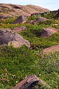
Wildflowers in Kugluktuk
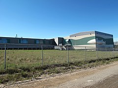
Grades 6 to 12 with a student population of about 150

The Roman Catholic Church at Kugluktuk


.jpg)


See also
Notes
- ^ Climate data was recorded at Coppermine from October 1930 to November 1977 and at Kugluktuk Airport from December 1977 to present.
References
- ^ "Kugluktuk". Geographical Names Data Base. Natural Resources Canada.
- ^ Hamlet of Kugluktuk
- ^ Nunavummiut elect new municipal leaders
- ^ Election Results 2013 General Election Archived 13 November 2013 at the Wayback Machine at Elections Nunavut
- ^ a b c d "Population and dwelling counts: Canada, provinces and territories, and census subdivisions (municipalities), Nunavut". Statistics Canada. 9 February 2022. Retrieved 19 February 2022.
- ^ Elevation at airport. Canada Flight Supplement. Effective 0901Z 16 July 2020 to 0901Z 10 September 2020.
- ^ a b "Population and dwelling counts: Canada and designated places". Statistics Canada. 9 February 2022. Retrieved 8 May 2022.
- ^ "The 1982 Plebiscite on Division of the Northwest Territories: Regional Government and Federal Policy" (PDF). Archived from the original (PDF) on 10 December 2019. Retrieved 25 August 2010.
- ^ a b "Kugluktuk A *". Canadian Climate Normals 1981–2010. Environment and Climate Change Canada. Climate ID: 2300902. Retrieved 30 April 2014.
- ^ a b "February 1968". Canadian Climate Data. Environment and Climate Change Canada. Climate ID: 2300900. Retrieved 25 June 2016.
- ^ "June 1934". Canadian Climate Data. Environment and Climate Change Canada. Climate ID: 2300900. Retrieved 25 June 2016.
- ^ "December 1934". Canadian Climate Data. Environment and Climate Change Canada. Climate ID: 2300900. Retrieved 25 June 2016.
- ^ "May 1941". Canadian Climate Data. Environment and Climate Change Canada. Climate ID: 2300900. Retrieved 25 June 2016.
- ^ "February 1943". Canadian Climate Data. Environment and Climate Change Canada. Climate ID: 2300900. Retrieved 25 June 2016.
- ^ "October 1943". Canadian Climate Data. Environment and Climate Change Canada. Climate ID: 2300900. Retrieved 25 June 2016.
- ^ "January 1947". Canadian Climate Data. Environment and Climate Change Canada. Climate ID: 2300900. Retrieved 25 June 2016.
- ^ "November 1948". Canadian Climate Data. Environment and Climate Change Canada. Climate ID: 2300900. Retrieved 25 June 2016.
- ^ "March 1949". Canadian Climate Data. Environment and Climate Change Canada. Climate ID: 2300900. Retrieved 25 June 2016.
- ^ "May 1952". Canadian Climate Data. Environment and Climate Change Canada. Climate ID: 2300900. Retrieved 25 June 2016.
- ^ "March 1955". Canadian Climate Data. Environment and Climate Change Canada. Climate ID: 2300900. Retrieved 25 June 2016.
- ^ "September 1957". Canadian Climate Data. Environment and Climate Change Canada. Climate ID: 2300900. Retrieved 25 June 2016.
- ^ "April 1958". Canadian Climate Data. Environment and Climate Change Canada. Climate ID: 2300900. Retrieved 25 June 2016.
- ^ "September 1970". Canadian Climate Data. Environment and Climate Change Canada. Climate ID: 2300900. Retrieved 25 June 2016.
- ^ "November 1970". Canadian Climate Data. Environment and Climate Change Canada. Climate ID: 2300900. Retrieved 25 June 2016.
- ^ "June 2013". Canadian Climate Data. Environment and Climate Change Canada. Climate ID: 2300902. Retrieved 25 June 2016.
- ^ "August 2013". Canadian Climate Data. Environment and Climate Change Canada. Climate ID: 2300902. Retrieved 25 June 2016.
- ^ "1981 Census of Canada: Census subdivisions in decreasing population order" (PDF). Statistics Canada. May 1992. Retrieved 1 February 2021.
- ^ "1986 Census: Population – Census Divisions and Census Subdivisions" (PDF). Statistics Canada. September 1987. Retrieved 1 February 2022.
- ^ "91 Census: Census Divisions and Census Subdivisions – Population and Dwelling Counts" (PDF). Statistics Canada. April 1992. Retrieved 1 February 2022.
- ^ "96 Census: A National Overview – Population and Dwelling Counts" (PDF). Statistics Canada. April 1997. Retrieved 1 February 2022.
- ^ "Population and Dwelling Counts, for Canada, Provinces and Territories, and Census Subdivisions (Municipalities), 2001 and 1996 Censuses – 100% Data (Nunavut)". Statistics Canada. 15 August 2012. Retrieved 1 February 2022.
- ^ "Population and dwelling counts, for Canada, provinces and territories, and census subdivisions (municipalities), 2006 and 2001 censuses – 100% data (Nunavut)". Statistics Canada. 20 August 2021. Retrieved 1 February 2022.
- ^ "Population and dwelling counts, for Canada, provinces and territories, and census subdivisions (municipalities), 2011 and 2006 censuses (Nunavut)". Statistics Canada. 25 July 2021. Retrieved 1 February 2022.
- ^ "Population and dwelling counts, for Canada, provinces and territories, and census subdivisions (municipalities), 2016 and 2011 censuses – 100% data (Nunavut)". Statistics Canada. 8 February 2017. Retrieved 1 February 2022.
- Office of the Languages Commissioner of Nunavut – PDF Dialect Map
- Office of the Languages Commissioner of Nunavut – Writing systems
Further reading
- Dredge, L. A. Where the river meets the sea geology and landforms of the lower Coppermine River Valley and Kugluktuk, Nunavut. [Ottawa]: Geological Survey of Canada, 2001. ISBN 0-660-18550-4
- Pedersen, Lena, and Donna Stephania. Crime Prevention in Kugluktuk. Ottawa: Caledon Institute of Social Policy, 1999. ISBN 1-894159-61-6
- Webarchive template wayback links
- Use Canadian English from April 2022
- Use dmy dates from April 2022
- Articles with short description
- Coordinates not on Wikidata
- Articles containing Inuktitut-language text
- All articles with unsourced statements
- Articles with unsourced statements from May 2022
- Articles needing additional references from May 2022
- All articles needing additional references
- Commons category link is the pagename
- Designated places in Nunavut
- Hamlets in the Kitikmeot Region
- Populated places in Arctic Canada
- Road-inaccessible communities of Nunavut