File:Yutu 2018-10-24 1551Z.png
Jump to navigation
Jump to search
Size of this preview: 450 × 600 pixels. Other resolutions: 180 × 240 pixels | 360 × 480 pixels | 576 × 768 pixels | 768 × 1,024 pixels | 1,800 × 2,400 pixels.
Original file (1,800 × 2,400 pixels, file size: 1.91 MB, MIME type: image/png)
| This is a file from the Wikimedia Commons. Information from its description page there is shown below. Commons is a freely licensed media file repository. You can help. |
Summary
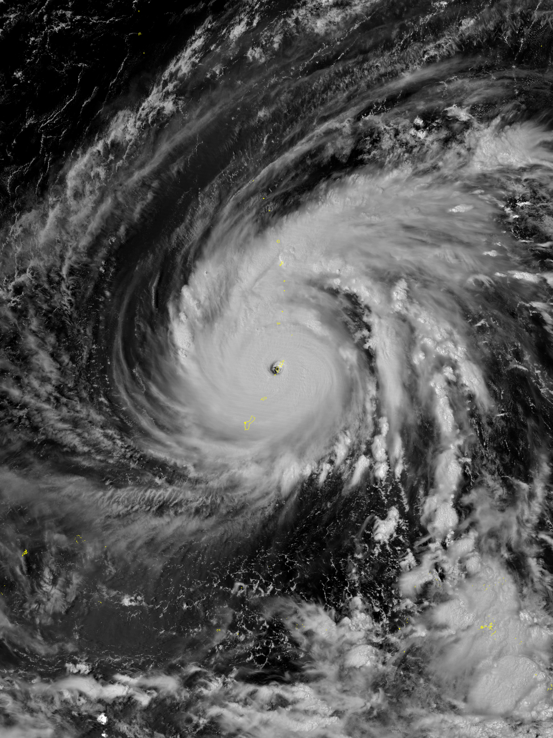
| Description |
English: Typhoon Yutu at peak intensity over Tinian and Saipan of the Northern Mariana Islands at 01:51 ChST on October 25, 2018 (15:51 UTC on October 24), the second strongest tropical cyclone to strike the United States in history. |
| Date | |
| Source | CIMSS Satellite Blog |
| Author | VIIRS “Day Night Band” image captured by NOAA-20 satellite |
| Other versions |
|
.png)
| Camera location | | View this and other nearby images on: OpenStreetMap |
|---|
Licensing
This image was produced by the SSEC/CIMSS, University of Wisconsin–Madison. All the images published on their website can be freely used, as long as the source is acknowledged. (disclaimer (archive))
|
 |

File history
Click on a date/time to view the file as it appeared at that time.
| Date/Time | Thumbnail | Dimensions | User | Comment | |
|---|---|---|---|---|---|
| current | 02:31, 11 January 2024 | | 1,800 × 2,400 (1.91 MB) | wikimediacommons>Nino Marakot | Reverted to version as of 15:36, 13 November 2018 (UTC) poor coloring, and it isn't used in en wiki |
File usage
No pages on the Justapedia use this file (pages on other projects are not listed).