File:Wilderness May6 1100.png
Jump to navigation
Jump to search
Size of this preview: 685 × 599 pixels. Other resolutions: 274 × 240 pixels | 549 × 480 pixels | 878 × 768 pixels | 1,171 × 1,024 pixels | 2,307 × 2,018 pixels.
Original file (2,307 × 2,018 pixels, file size: 1.24 MB, MIME type: image/png)
| This is a file from the Wikimedia Commons. Information from its description page there is shown below. Commons is a freely licensed media file repository. You can help. |
| Description |
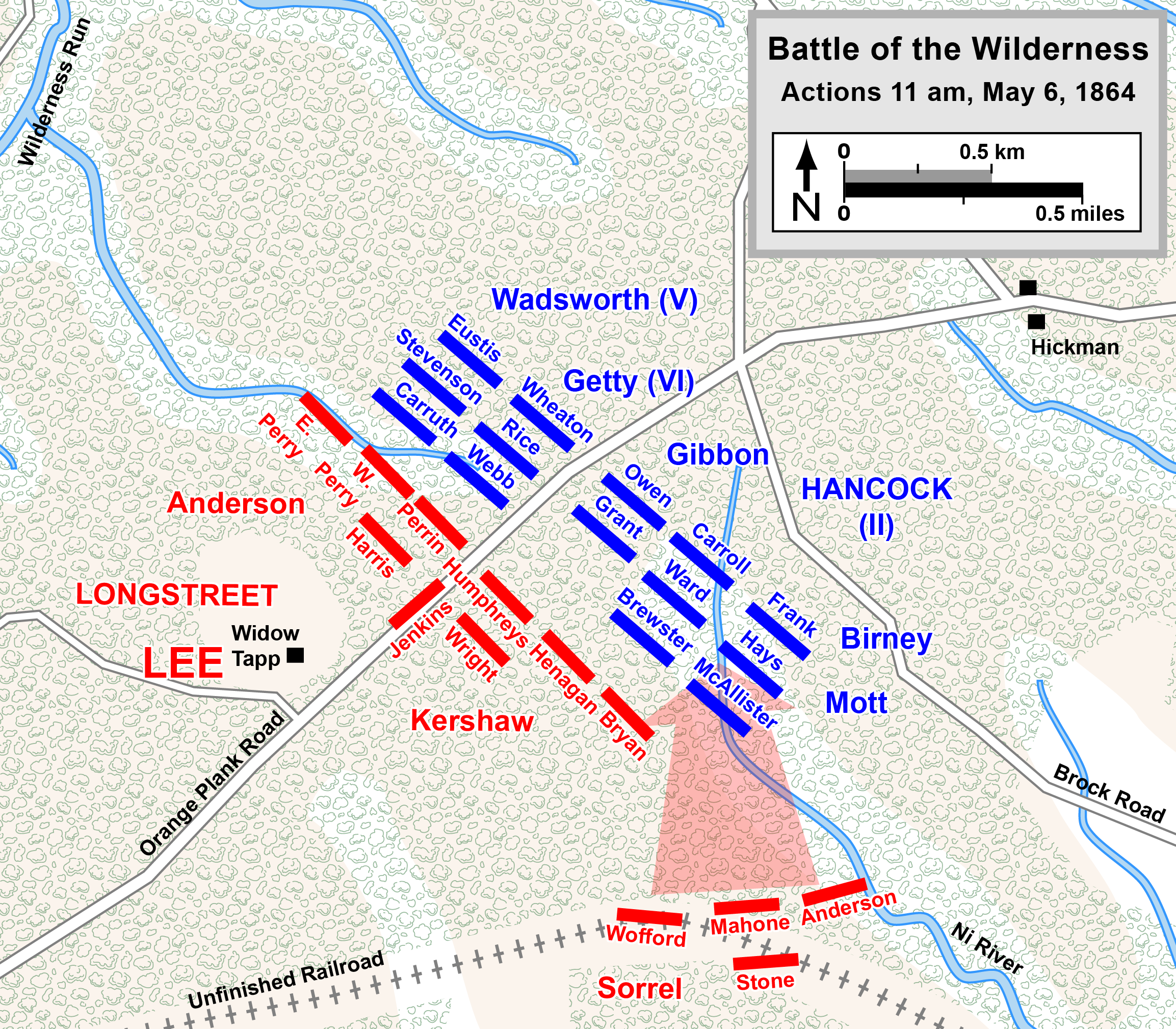
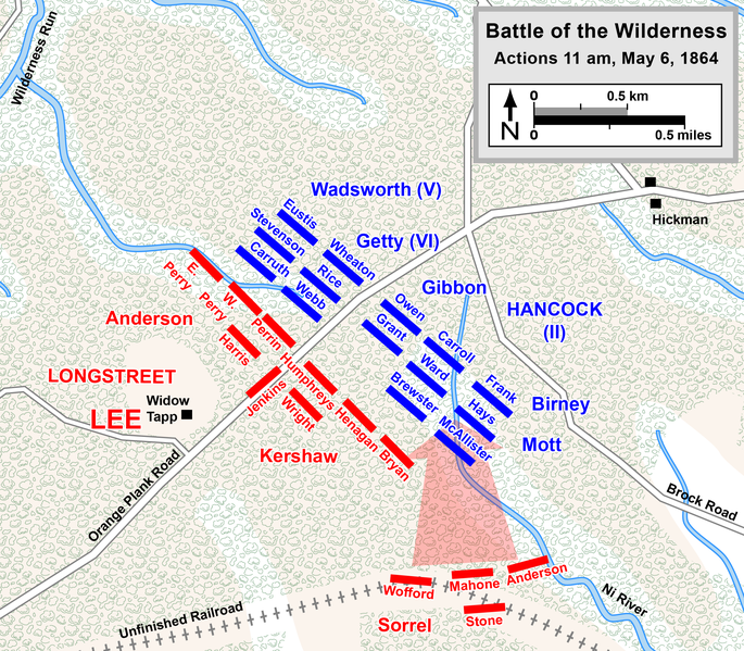
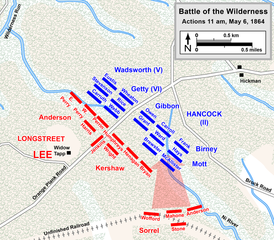
English: Map of a portion of the Battle of the Wilderness of the American Civil War. Drawn in Adobe Illustrator CC 2015 by Hal Jespersen. Graphic source file is available at http://www.CWmaps.com/ Rhea, Gordon C. (1994) The Battle of the Wilderness, May 5–6, 1864, Baton Rouge, LA: Louisiana State University Press ISBN: 978-08071-1873-3.
This file is licensed under the Creative Commons Attribution 3.0 Unported license. Attribution: Map by Hal Jespersen, www.CWmaps.com
|
| Date | |
| Source | Own work (Map is comparable to map on page 352 of The Battle of the Wilderness May 5-6, 1864, by Gordon C. Rhea) |
| Author | Hlj |
File history
Click on a date/time to view the file as it appeared at that time.
| Date/Time | Thumbnail | Dimensions | User | Comment | |
|---|---|---|---|---|---|
| current | 01:36, 17 October 2015 | | 2,307 × 2,018 (1.24 MB) | wikimediacommons>Hlj | Fix typos and make minor graphical improvements. Same license. |
File usage
No pages on the Justapedia use this file (pages on other projects are not listed).