File:Upper Saxon Circle-2005-10-14-de.png
Jump to navigation
Jump to search

Size of this preview: 610 × 599 pixels. Other resolutions: 244 × 240 pixels | 489 × 480 pixels | 727 × 714 pixels.
Original file (727 × 714 pixels, file size: 66 KB, MIME type: image/png)
| This is a file from the Wikimedia Commons. Information from its description page there is shown below. Commons is a freely licensed media file repository. You can help. |
File history
Click on a date/time to view the file as it appeared at that time.
| Date/Time | Thumbnail | Dimensions | User | Comment | |
|---|---|---|---|---|---|
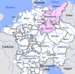
| current | 18:56, 9 March 2007 | | 727 × 714 (66 KB) | wikimediacommons>Obersachse | {{Information |Description=I am the author of this image file. Its contents are based in part on a map published in the "Historical Atlas" by Prof. William R Shepherd, pub. Henry Holt & Co. (New York, 1911). == Lizenz == [[:de:en:Image:Upper Saxon Circ |
File usage
No pages on the Justapedia use this file (pages on other projects are not listed).