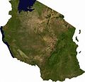
File:Tanzania sat.JPG
Jump to navigation
Jump to search

Size of this preview: 620 × 599 pixels. Other resolutions: 248 × 240 pixels | 497 × 480 pixels | 795 × 768 pixels | 1,060 × 1,024 pixels | 1,336 × 1,291 pixels.
Original file (1,336 × 1,291 pixels, file size: 1.23 MB, MIME type: image/jpeg)
File history
Click on a date/time to view the file as it appeared at that time.
| Date/Time | Thumbnail | Dimensions | User | Comment | |
|---|---|---|---|---|---|
| current | 10:42, 5 December 2006 |  | 1,336 × 1,291 (1.23 MB) | wikimediacommons>Moyogo | ECW to TIFF to PNG (compression level 9). {{PD-MapLibrary}} |
File usage
The following pages use this file on Justapedia (pages on other projects are not listed):
Metadata
BoilerPlate was here
